Rättvik night lights from space
Night Light of Rättvik (Dalarna) from space (Sweden) Src. Average luminocity for 10x10km area is 9.4318% and for 50x50km: 1.4168%.
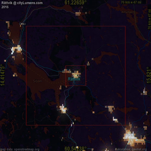
Analysis of Rättvik night lights 2016
Square area 10x10 km:
100  0%
0%
90-99 0%
80-89 0%
70-79 0.62%
60-69 4.86%
50-59 3.51%
40-49 3%
30-39 1.24%
20-29 0%
10-19 0.21%
0-9 86.57%
0%90-99
0%80-89
0%70-79
0.62%60-69
4.86%50-59
3.51%40-49
3%30-39
1.24%20-29
0%10-19
0.21%0-9
86.57%Square area 50x50 km:
100 0.13%
90-99 0.13%
80-89 0.08%
70-79 0.1%
60-69 0.27%
50-59 0.43%
40-49 0.35%
30-39 0.28%
20-29 0.04%
10-19 0.24%
0-9 97.96%
0.13%90-99
0.13%80-89
0.08%70-79
0.1%60-69
0.27%50-59
0.43%40-49
0.35%30-39
0.28%20-29
0.04%10-19
0.24%0-9
97.96%Clear (daylight) street map image can be seen on geolist.org.
Map coordinates:
61° 13' 35.7" North, 14° 24' 53.1" East
60° 53' 10.8" North, 15° 7' 4.3" East
60° 32' 32.6" North, 15° 49' 15.6" East
Some cities around Rättvik sort by population:
• Borlänge
47.8 km =29.7 mi,  158°
158°
• Falun
41.8 km =26 mi,  138°
138°
• Ludvika
82 km =51 mi,  177°
177°
• Mora
33.8 km =21 mi,  293°
293°
• Hedemora
82.5 km =51.3 mi, 144°
• Leksand
18.5 km =11.5 mi,  200°
200°
• Hofors
74 km =46 mi,  120°
120°
• Orsa
37.6 km =23.4 mi,  313°
313°
2682995 (p: 5,160)
Sources (retrieved 2019-11-25):
» Earth at Night: Flat Maps 2012, 2016