Leksand night lights from space
Night Light of Leksand (Dalarna) from space (Sweden) Src. Average luminocity for 10x10km area is 11.4015% and for 50x50km: 2.3363%.
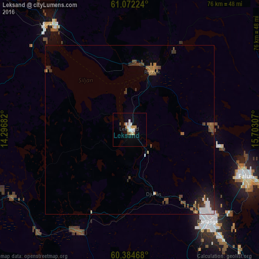
Analysis of Leksand night lights 2016
Square area 10x10 km:
 2.38%
2.38%90-99
2.16%80-89
0.65%70-79
2.06%60-69
0.97%50-59
1.52%40-49
0.65%30-39
0%20-29
0%10-19
5.84%0-9
83.77%Square area 50x50 km:
0.36%90-99
0.31%80-89
0.1%70-79
0.17%60-69
0.36%50-59
0.58%40-49
0.45%30-39
0.41%20-29
0.42%10-19
0.82%0-9
96.03%Clear (daylight) street map image can be seen on geolist.org.
Map coordinates:
61° 4' 20.1" North, 14° 17' 48.6" East
60° 43' 49.1" North, 14° 59' 59.8" East
60° 23' 4.8" North, 15° 42' 11.1" East
Some cities around Leksand sort by population:
• Borlänge
36.2 km =22.5 mi,  138°
138°
• Falun
36.9 km =22.9 mi,  112°
112°
• Ludvika
65.4 km =40.6 mi,  170°
170°
• Mora
39.5 km =24.5 mi,  321°
321°
• Hofors
73.1 km =45.4 mi, 106°
• Orsa
48.1 km =29.9 mi,  334°
334°
• Smedjebacken
69.3 km =43.1 mi,  160°
160°
• Rättvik
18.5 km =11.5 mi,  20°
20°
2696650 (p: 6,107)
Sources (retrieved 2019-11-25):
» Earth at Night: Flat Maps 2012, 2016