Piteå night lights from space
Night Light of Piteå (Norrbotten) from space (Sweden) Src. Average luminocity for 10x10km area is 47.0842% and for 50x50km: 2.605%.
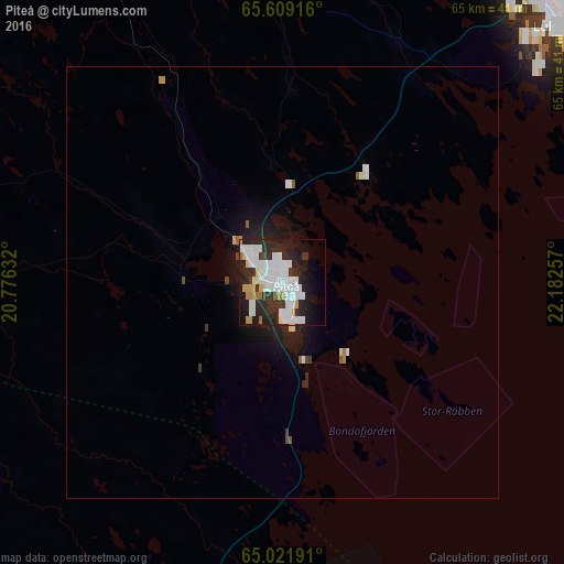
Analysis of Piteå night lights 2016
Square area 10x10 km:
 17.03%
90-99
13.64%80-89
2.66%70-79
4.03%60-69
2.01%50-59
0.73%40-49
0.46%30-39
6.32%20-29
19.14%10-19
15.57%0-9
18.41%Square area 50x50 km:
0.73%90-99
0.62%80-89
0.14%70-79
0.21%60-69
0.11%50-59
0.11%40-49
0.11%30-39
0.33%20-29
0.98%10-19
1.91%0-9
94.75%Clear (daylight) street map image can be seen on geolist.org.
Map coordinates:
65° 36' 33" North, 20° 46' 34.8" East
65° 19' 1.8" North, 21° 28' 46" East
65° 1' 18.9" North, 22° 10' 57.3" East
Some cities around Piteå sort by population:
• Luleå
43.1 km =26.8 mi,  46°
46°
• Skellefteå
67.7 km =42.1 mi,  201°
201°
• Kemi, FI
149.5 km =92.9 mi,  71°
71°
• Tornio, FI
136.1 km =84.6 mi,  64°
64°
• Boden
57.3 km =35.6 mi,  9°
9°
• Kalix
97.4 km =60.5 mi, 52°
• Haparanda
135.1 km =83.9 mi, 64°
• Ylitornio, FI
148.9 km =92.5 mi,  42°
42°
603570 (p: 23,067)
Sources (retrieved 2019-11-25):
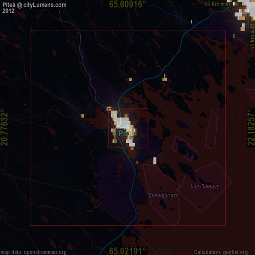
» Earth at Night: Flat Maps 2012, 2016