Boden night lights from space
Night Light of Boden (Norrbotten) from space (Sweden) Src. Average luminocity for 10x10km area is 32.8086% and for 50x50km: 3.3013%.
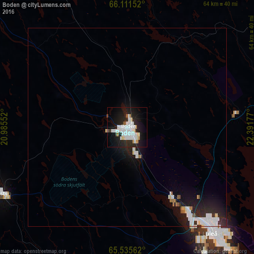
Analysis of Boden night lights 2016
Square area 10x10 km:
 9.53%
9.53%90-99
10.84%80-89
1.49%70-79
2.01%60-69
0.61%50-59
1.05%40-49
0.35%30-39
0.96%20-29
13.81%10-19
27.19%0-9
32.17%Square area 50x50 km:
0.87%90-99
0.92%80-89
0.18%70-79
0.15%60-69
0.19%50-59
0.12%40-49
0.05%30-39
0.19%20-29
1.39%10-19
2.89%0-9
93.05%Clear (daylight) street map image can be seen on geolist.org.
Map coordinates:
66° 6' 41.5" North, 20° 59' 7.9" East
65° 49' 30.6" North, 21° 41' 19.1" East
65° 32' 8.2" North, 22° 23' 30.4" East
Some cities around Boden sort by population:
• Luleå
34.2 km =21.3 mi,  141°
141°
• Skellefteå
124.3 km =77.2 mi,  195°
195°
• Piteå
57.3 km =35.6 mi,  189°
189°
• Tornio, FI
111.9 km =69.5 mi,  88°
88°
• Keminmaa, FI
130.1 km =80.8 mi, 91°
• Kalix
66.9 km =41.6 mi, 87°
• Haparanda
111.5 km =69.3 mi, 89°
• Ylitornio, FI
104.6 km =65 mi,  59°
59°
606531 (p: 16,830)
Sources (retrieved 2019-11-25):
» Earth at Night: Flat Maps 2012, 2016