Fristad night lights from space
Night Light of Fristad (Västra Götaland) from space (Sweden) Src. Average luminocity for 10x10km area is 2.9886% and for 50x50km: 3.8684%.
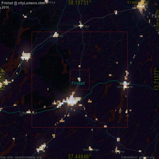
Analysis of Fristad night lights 2016
Square area 10x10 km:
 0.11%
0.11%90-99
0.34%80-89
0.45%70-79
0%60-69
0.91%50-59
0.45%40-49
0%30-39
0%20-29
0%10-19
1.82%0-9
95.91%Square area 50x50 km:
0.77%90-99
0.76%80-89
0.4%70-79
0.18%60-69
0.58%50-59
0.34%40-49
0.32%30-39
0.22%20-29
0.76%10-19
3.2%0-9
92.47%Clear (daylight) street map image can be seen on geolist.org.
Map coordinates:
58° 11' 50.3" North, 12° 18' 27.1" East
57° 49' 29.4" North, 13° 0' 38.3" East
57° 26' 54.5" North, 13° 42' 49.6" East
Some cities around Fristad sort by population:
• Borås
12.3 km =7.6 mi,  199°
199°
• Lerum
44.4 km =27.6 mi,  262°
262°
• Alingsås
30.6 km =19 mi,  292°
292°
• Kinna
40 km =24.9 mi,  208°
208°
• Ulricehamn
24.2 km =15 mi,  98°
98°
• Landvetter
49.8 km =30.9 mi,  252°
252°
• Gråbo
42.1 km =26.2 mi,  271°
271°
• Vårgårda
26.4 km =16.4 mi,  333°
333°
2713661 (p: 5,409)
Sources (retrieved 2019-11-25):
» Earth at Night: Flat Maps 2012, 2016