Ad-Damazin night lights from space
Night Light of Ad-Damazin (Blue Nile) from space (Sudan) Src. Average luminocity for 10x10km area is 20.9483% and for 50x50km: 1.2264%.
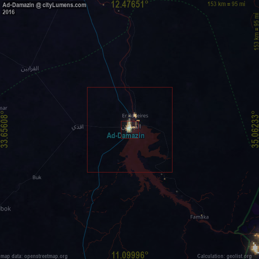
Analysis of Ad-Damazin night lights 2016
Square area 10x10 km:
 0%
0%90-99
3.31%80-89
5.58%70-79
0.62%60-69
3.1%50-59
2.48%40-49
6.2%30-39
4.75%20-29
2.48%10-19
11.98%0-9
59.5%Square area 50x50 km:
0%90-99
0.13%80-89
0.29%70-79
0.15%60-69
0.13%50-59
0.15%40-49
0.29%30-39
0.27%20-29
0.1%10-19
0.63%0-9
97.85%Clear (daylight) street map image can be seen on geolist.org.
Map coordinates:
12° 28' 35.4" North, 33° 39' 21.9" East
11° 47' 20.8" North, 34° 21' 33.1" East
11° 5' 59.9" North, 35° 3' 44.4" East
Some cities around Ad-Damazin sort by population:
• Singa
158.1 km =98.2 mi,  342°
342°
• As Sūkī
177.5 km =110.3 mi, 343°
• Ar Ruseris
9.1 km =5.7 mi,  19°
19°
• Al Ḩawātah
183.4 km =114 mi,  9°
9°
• Ad Dindar
158.3 km =98.4 mi,  352°
352°
• Kurmuk
138 km =85.7 mi,  183°
183°
• Jalqani
74.9 km =46.5 mi, 348°
• Renk, SS
169.3 km =105.2 mi,  268°
268°
380174 (p: 186,051)
Sources (retrieved 2019-11-25):
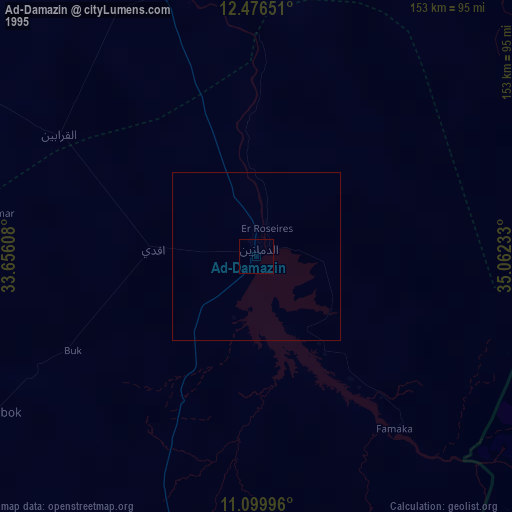
» NASA, Earths city lights 1995
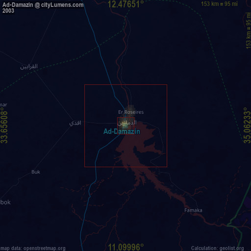
» NASA city lights 2003
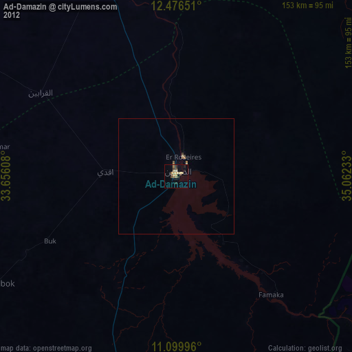
» Earth at Night: Flat Maps 2012, 2016