Tabuk night lights from space
Night Light of Tabuk from space (Saudi Arabia) Src. Average luminocity for 10x10km area is 99.1071% and for 50x50km: 19.4495%.

Analysis of Tabuk night lights 2016
Square area 10x10 km:
 71.83%
90-99
25.2%80-89
2.78%70-79
0.2%60-69
0%50-59
0%40-49
0%30-39
0%20-29
0%10-19
0%0-9
0%Square area 50x50 km:
4.96%90-99
3.53%80-89
1.78%70-79
1.81%60-69
3.52%50-59
2.93%40-49
2.18%30-39
2.72%20-29
3.23%10-19
6.82%0-9
66.53%Clear (daylight) street map image can be seen on geolist.org.
Map coordinates:
29° 0' 59.4" North, 35° 52' 6.2" East
28° 23' 59.3" North, 36° 34' 17.4" East
27° 46' 46.2" North, 37° 16' 28.7" East
Some cities around Tabuk sort by population:
• Aqaba, JO
197.1 km =122.5 mi,  309°
309°
• Ma'an, JO
215.6 km =134 mi,  337°
337°
• Eilat, IL
203.8 km =126.6 mi, 309°
• Duba
145.2 km =90.2 mi,  216°
216°
• Petra, JO
238.4 km =148.1 mi,  333°
333°
• Sharm el-Sheikh, EG
226.2 km =140.6 mi,  256°
256°
• Dahab, EG
203.2 km =126.3 mi,  272°
272°
• Al Quwayrah, JO
198.1 km =123.1 mi,  321°
321°
101628 (p: 455,450)
Sources (retrieved 2019-11-25):
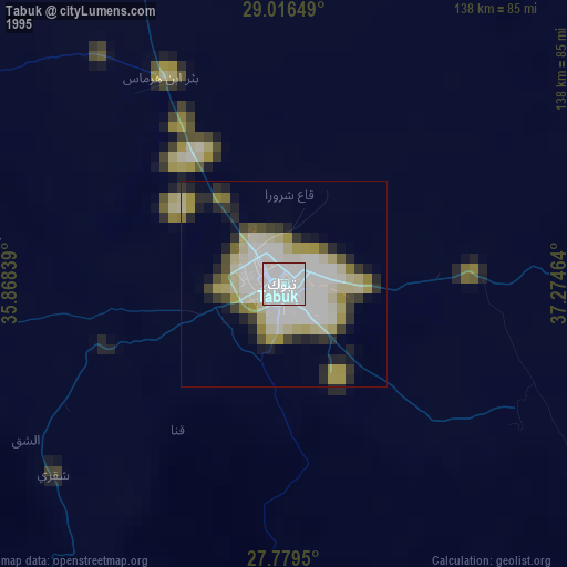
» NASA, Earths city lights 1995
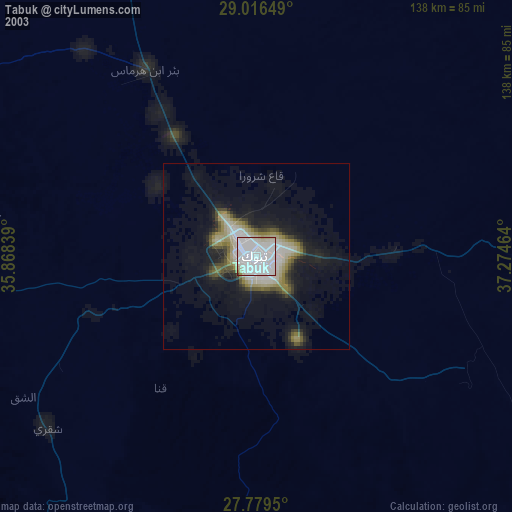
» NASA city lights 2003
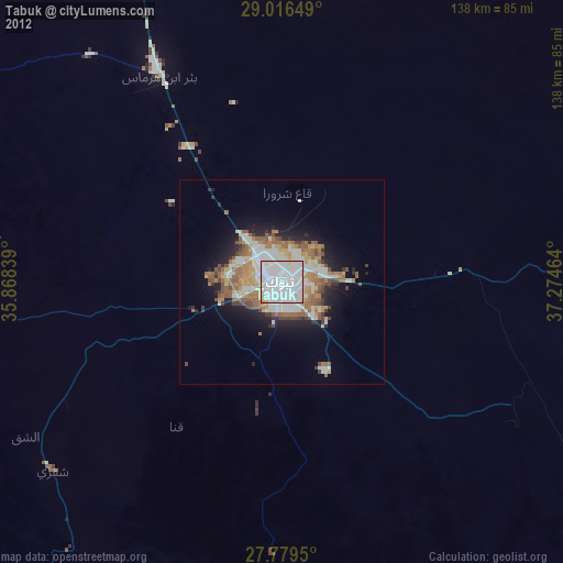
» Earth at Night: Flat Maps 2012, 2016