Najrān night lights from space
Night Light of Najrān (Najran) from space (Saudi Arabia) Src. Average luminocity for 10x10km area is 88.3595% and for 50x50km: 25.2476%.
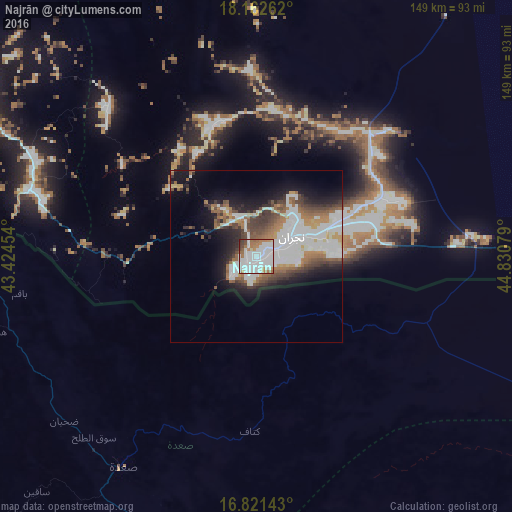
Analysis of Najrān night lights 2016
Square area 10x10 km:
 46.28%
90-99
24.59%80-89
1.45%70-79
3.93%60-69
14.67%50-59
3.51%40-49
3.93%30-39
1.45%20-29
0.21%10-19
0%0-9
0%Square area 50x50 km:
7.68%90-99
5.93%80-89
0.95%70-79
1.88%60-69
3.7%50-59
3.09%40-49
3.48%30-39
3.07%20-29
3.98%10-19
9.05%0-9
57.2%Clear (daylight) street map image can be seen on geolist.org.
Map coordinates:
18° 9' 45.4" North, 43° 25' 28.3" East
17° 29' 35.7" North, 44° 7' 39.6" East
16° 49' 17.1" North, 44° 49' 50.8" East
Some cities around Najrān sort by population:
• Şabyā
164 km =101.9 mi,  256°
256°
• Sa'dah, YE
72.6 km =45.1 mi,  212°
212°
• Abū ‘Arīsh
149.4 km =92.8 mi,  247°
247°
• Şāmitah
160.6 km =99.8 mi,  231°
231°
• Al Ḩazm, YE
163.1 km =101.3 mi,  154°
154°
• Al Jarādīyah
164.4 km =102.2 mi, 231°
• Mislīyah
166.6 km =103.5 mi,  268°
268°
• Mizhirah
165.7 km =103 mi,  243°
243°
103630 (p: 258,573)
Sources (retrieved 2019-11-25):
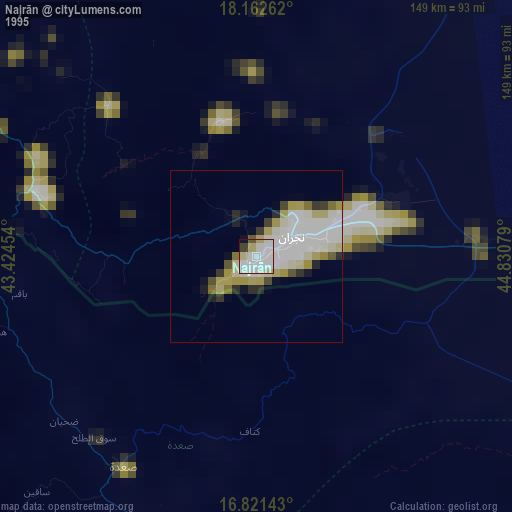
» NASA, Earths city lights 1995
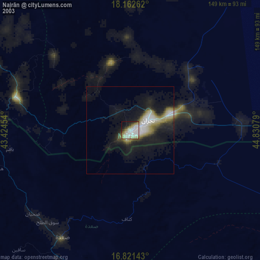
» NASA city lights 2003
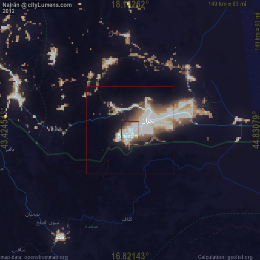
» Earth at Night: Flat Maps 2012, 2016