Julayjilah night lights from space
Night Light of Julayjilah (Eastern Province) from space (Saudi Arabia) Src. Average luminocity for 10x10km area is 79.9563% and for 50x50km: 38.7653%.
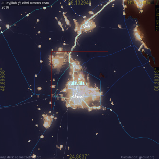
Analysis of Julayjilah night lights 2016
Square area 10x10 km:
 16.07%
90-99
23.81%80-89
11.71%70-79
17.26%60-69
21.23%50-59
3.57%40-49
2.58%30-39
2.18%20-29
1.59%10-19
0%0-9
0%Square area 50x50 km:
7.58%90-99
8.66%80-89
4.48%70-79
5.06%60-69
8.97%50-59
4.76%40-49
4.06%30-39
4.96%20-29
6.28%10-19
8.68%0-9
36.51%Clear (daylight) street map image can be seen on geolist.org.
Map coordinates:
26° 7' 58.6" North, 48° 53' 48.8" East
25° 30' 0" North, 49° 36' 0" East
24° 51' 49.3" North, 50° 18' 11.3" East
Some cities around Julayjilah sort by population:
• Al Hufūf
15.1 km =9.4 mi,  184°
184°
• Al Mubarraz
10.3 km =6.4 mi,  185°
185°
• Al Baţţālīyah
8.1 km =5 mi,  155°
155°
• Al Munayzilah
14.6 km =9.1 mi,  152°
152°
• Al Qurayn
1.9 km =1.2 mi, 180°
• Al Jubayl
12.2 km =7.6 mi, 155°
• Al Qārah
11.4 km =7.1 mi,  144°
144°
• Al Muţayrifī
4.8 km =3 mi,  240°
240°
105252 (p: 5,359)
Sources (retrieved 2019-11-25):
» Earth at Night: Flat Maps 2012, 2016