Al Jubayl night lights from space
Night Light of Al Jubayl (Eastern Province) from space (Saudi Arabia) Src. Average luminocity for 10x10km area is 93.7183% and for 50x50km: 37.1651%.
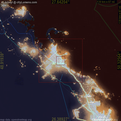
Analysis of Al Jubayl night lights 2016
Square area 10x10 km:
 40.67%
90-99
38.89%80-89
6.75%70-79
7.74%60-69
4.56%50-59
1.39%40-49
0%30-39
0%20-29
0%10-19
0%0-9
0%Square area 50x50 km:
6.33%90-99
7.83%80-89
4.2%70-79
4.27%60-69
8.67%50-59
5.32%40-49
5.1%30-39
5.82%20-29
7.05%10-19
10.08%0-9
35.34%Clear (daylight) street map image can be seen on geolist.org.
Map coordinates:
27° 38' 31.3" North, 48° 55' 9.8" East
27° 1' 2.6" North, 49° 37' 21" East
26° 23' 21.4" North, 50° 19' 32.3" East
Some cities around Al Jubayl sort by population:
• Al Qaţīf
63.2 km =39.3 mi,  142°
142°
• Tārūt
64.5 km =40.1 mi, 139°
• Sayhāt
72.9 km =45.3 mi, 144°
• Şafwá
52.5 km =32.6 mi, 141°
• Raḩīmah
55.5 km =34.5 mi,  128°
128°
• Umm as Sāhik
49.9 km =31 mi, 144°
• Al Awjām
59.7 km =37.1 mi,  147°
147°
• At Tūbī
62.9 km =39.1 mi, 144°
109435 (p: 237,274)
Sources (retrieved 2019-11-25):
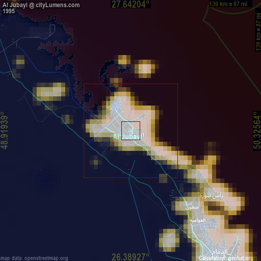
» NASA, Earths city lights 1995
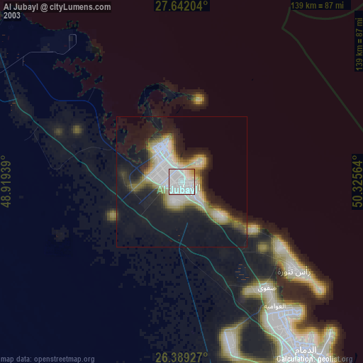
» NASA city lights 2003
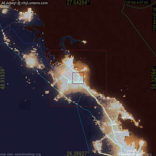
» Earth at Night: Flat Maps 2012, 2016