Yurty night lights from space
Night Light of Yurty (Irkutsk Oblast) from space (Russia) Src. Average luminocity for 10x10km area is 4.4844% and for 50x50km: 1.5957%.
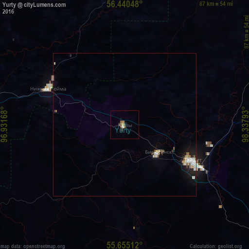
Analysis of Yurty night lights 2016
Square area 10x10 km:
 0.24%
0.24%90-99
0.24%80-89
1.08%70-79
0.36%60-69
1.32%50-59
0.36%40-49
0.72%30-39
1.08%20-29
1.32%10-19
0%0-9
93.3%Square area 50x50 km:
0.3%90-99
0.32%80-89
0.22%70-79
0.04%60-69
0.17%50-59
0.18%40-49
0.13%30-39
0.13%20-29
0.28%10-19
1.05%0-9
97.19%Clear (daylight) street map image can be seen on geolist.org.
Map coordinates:
56° 26' 25.7" North, 96° 55' 54" East
56° 2' 59.3" North, 97° 38' 5.3" East
55° 39' 18.4" North, 98° 20' 16.5" East
Some cities around Yurty sort by population:
• Tayshet
26.3 km =16.3 mi,  119°
119°
• Ilanskiy
99.3 km =61.7 mi,  281°
281°
• Aban
119.3 km =74.1 mi,  305°
305°
• Biryusinsk
15.2 km =9.4 mi,  129°
129°
• Nizhnyaya Poyma
29.5 km =18.3 mi,  295°
295°
• Nizhniy Ingash
70 km =43.5 mi, 283°
• Alzamay
84.6 km =52.6 mi, 130°
• Lesogorsk
116.7 km =72.5 mi,  90°
90°
1485680 (p: 5,902)
Sources (retrieved 2019-11-25):
» Earth at Night: Flat Maps 2012, 2016