Biryusinsk night lights from space
Night Light of Biryusinsk (Irkutsk Oblast) from space (Russia) Src. Average luminocity for 10x10km area is 8.2895% and for 50x50km: 2.1346%.
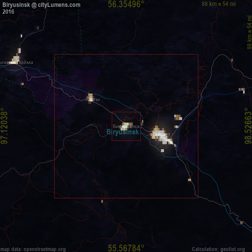
Analysis of Biryusinsk night lights 2016
Square area 10x10 km:
 1.5%
1.5%90-99
1.5%80-89
1.5%70-79
0%60-69
0.5%50-59
1%40-49
1.75%30-39
0.75%20-29
0.5%10-19
0.5%0-9
90.48%Square area 50x50 km:
0.4%90-99
0.42%80-89
0.26%70-79
0.04%60-69
0.21%50-59
0.31%40-49
0.18%30-39
0.15%20-29
0.3%10-19
1.79%0-9
95.94%Clear (daylight) street map image can be seen on geolist.org.
Map coordinates:
56° 21' 17.9" North, 97° 7' 13.4" East
55° 57' 48.2" North, 97° 49' 24.6" East
55° 34' 4.2" North, 98° 31' 35.9" East
Some cities around Biryusinsk sort by population:
• Tayshet
11.7 km =7.3 mi,  106°
106°
• Ilanskiy
113.1 km =70.3 mi,  285°
285°
• Chunskiy
113.3 km =70.4 mi,  83°
83°
• Nizhnyaya Poyma
44.3 km =27.5 mi,  300°
300°
• Nizhniy Ingash
84 km =52.2 mi, 288°
• Alzamay
69.4 km =43.1 mi,  130°
130°
• Yurty
15.2 km =9.4 mi,  309°
309°
• Lesogorsk
105.5 km =65.6 mi,  85°
85°
1510041 (p: 9,583)
Sources (retrieved 2019-11-25):
» Earth at Night: Flat Maps 2012, 2016