Yurga night lights from space
Night Light of Yurga (Kemerovo Oblast) from space (Russia) Src. Average luminocity for 10x10km area is 47.9199% and for 50x50km: 3.0297%.
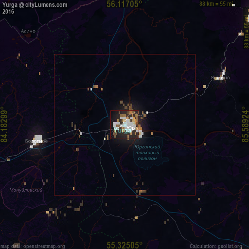
Analysis of Yurga night lights 2016
Square area 10x10 km:
 12.68%
90-99
11.36%80-89
2.99%70-79
4.19%60-69
6.7%50-59
5.38%40-49
3.71%30-39
2.51%20-29
22.73%10-19
20.45%0-9
7.3%Square area 50x50 km:
0.57%90-99
0.6%80-89
0.12%70-79
0.22%60-69
0.41%50-59
0.43%40-49
0.48%30-39
0.3%20-29
1.01%10-19
2.26%0-9
93.59%Clear (daylight) street map image can be seen on geolist.org.
Map coordinates:
56° 7' 1.4" North, 84° 10' 58.8" East
55° 43' 23" North, 84° 53' 10" East
55° 19' 30.2" North, 85° 35' 21.3" East
Some cities around Yurga sort by population:
• Anzhero-Sudzhensk
81.6 km =50.7 mi,  60°
60°
• Topki
67.6 km =42 mi,  137°
137°
• Tayga
59.5 km =37 mi,  50°
50°
• Toguchin
62.7 km =39 mi,  210°
210°
• Kedrovka
79.1 km =49.2 mi,  106°
106°
• Bolotnoye
31.1 km =19.3 mi,  259°
259°
• Yashkino
37.7 km =23.4 mi, 63°
• Pioner
80.8 km =50.2 mi,  123°
123°
1485724 (p: 84,220)
Sources (retrieved 2019-11-25):
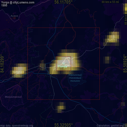
» NASA, Earths city lights 1995
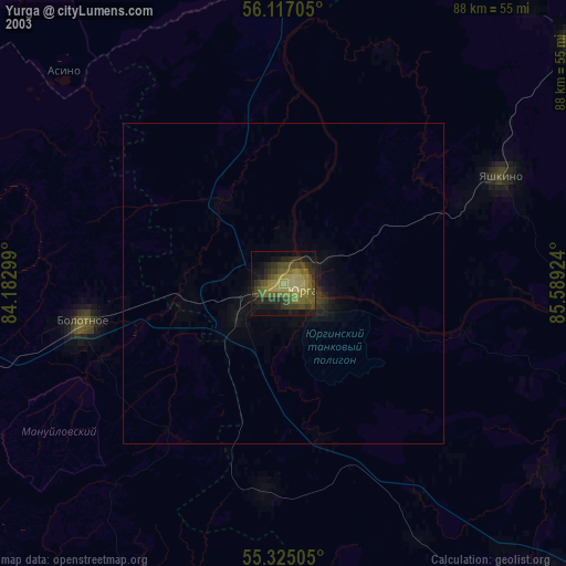
» NASA city lights 2003
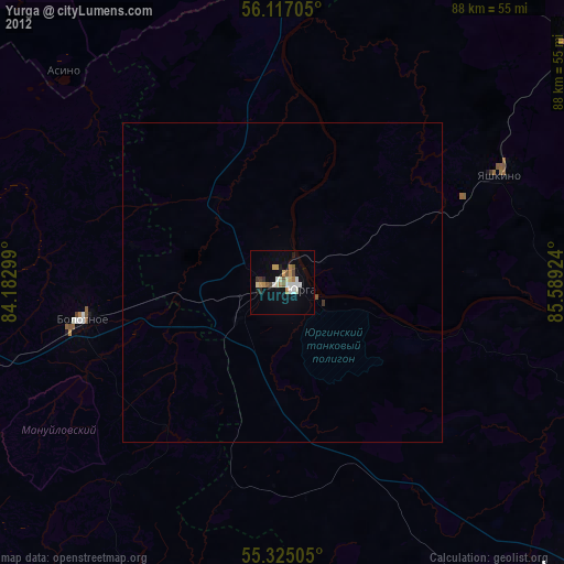
» Earth at Night: Flat Maps 2012, 2016