Yubileyny night lights from space
Night Light of Yubileyny (Moscow Oblast) from space (Russia) Src. Average luminocity for 10x10km area is 88.9073% and for 50x50km: 54.1871%.
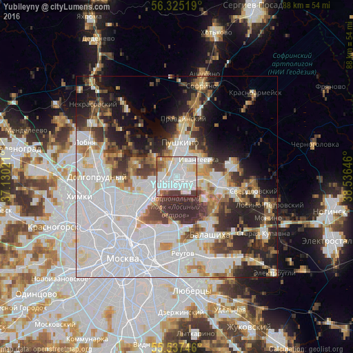
Analysis of Yubileyny night lights 2016
Square area 10x10 km:
 50.25%
90-99
20.93%80-89
8.27%70-79
4.76%60-69
4.26%50-59
2.88%40-49
3.51%30-39
5.14%20-29
0%10-19
0%0-9
0%Square area 50x50 km:
24.49%90-99
10.38%80-89
4.2%70-79
4.05%60-69
4.36%50-59
4.21%40-49
4.18%30-39
6.37%20-29
9%10-19
8.86%0-9
19.9%Clear (daylight) street map image can be seen on geolist.org.
Map coordinates:
56° 19' 30.7" North, 37° 7' 48.8" East
55° 55' 60" North, 37° 49' 60" East
55° 32' 14.9" North, 38° 32' 11.3" East
Some cities around Yubileyny sort by population:
• Mytishchi
6.8 km =4.2 mi,  249°
249°
• Korolev
2.2 km =1.4 mi,  192°
192°
• Shchelkovo
8.7 km =5.4 mi,  96°
96°
• Ivanteyevka
6.9 km =4.3 mi,  52°
52°
• Bolshevo
0.3 km =0.2 mi,  309°
309°
• Mamontovka
5.3 km =3.3 mi,  350°
350°
• Zagoryanskiy
7.8 km =4.8 mi,  90°
90°
• Pirogovskiy
8 km =5 mi, 308°
536206 (p: 32,508)
Sources (retrieved 2019-11-25):
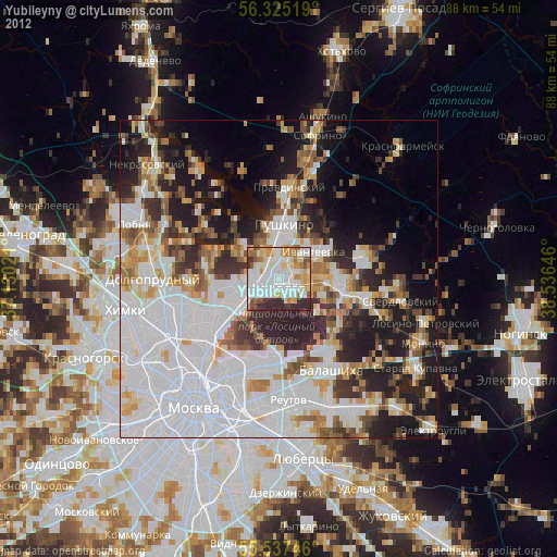
» Earth at Night: Flat Maps 2012, 2016