Ivanteyevka night lights from space
Night Light of Ivanteyevka (Moscow Oblast) from space (Russia) Src. Average luminocity for 10x10km area is 74.688% and for 50x50km: 40.8016%.
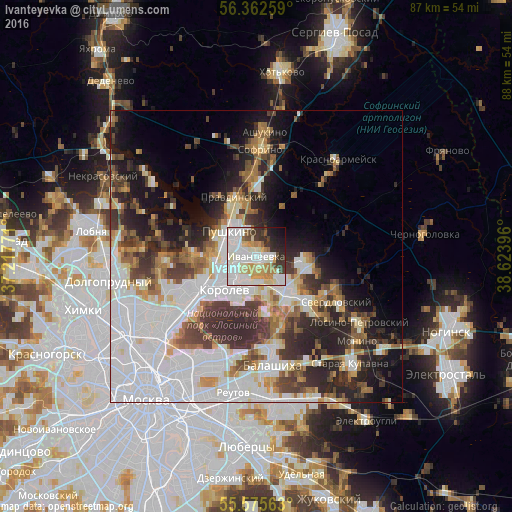
Analysis of Ivanteyevka night lights 2016
Square area 10x10 km:
 27.32%
90-99
23.18%80-89
9.15%70-79
8.4%60-69
3.76%50-59
2.26%40-49
4.01%30-39
7.89%20-29
6.77%10-19
6.27%0-9
1%Square area 50x50 km:
15.64%90-99
7.69%80-89
3.19%70-79
3.45%60-69
4.01%50-59
3.71%40-49
4.03%30-39
6.04%20-29
8.38%10-19
9.45%0-9
34.41%Clear (daylight) street map image can be seen on geolist.org.
Map coordinates:
56° 21' 45.3" North, 37° 13' 3.8" East
55° 58' 16" North, 37° 55' 15" East
55° 34' 32.3" North, 38° 37' 26.3" East
Some cities around Ivanteyevka sort by population:
• Korolev
8.7 km =5.4 mi,  223°
223°
• Shchelkovo
6 km =3.7 mi,  148°
148°
• Pushkino
6.1 km =3.8 mi,  326°
326°
• Fryazino
7.9 km =4.9 mi,  98°
98°
• Yubileyny
6.9 km =4.3 mi,  232°
232°
• Bolshevo
6.9 km =4.3 mi, 234°
• Mamontovka
6.4 km =4 mi,  279°
279°
• Zagoryanskiy
4.9 km =3 mi, 151°
555111 (p: 51,085)
Sources (retrieved 2019-11-25):
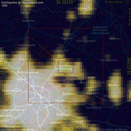
» NASA, Earths city lights 1995
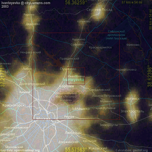
» NASA city lights 2003
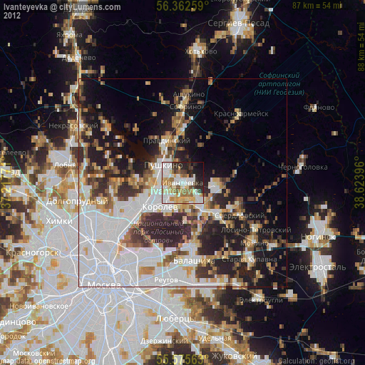
» Earth at Night: Flat Maps 2012, 2016