Pirogovskiy night lights from space
Night Light of Pirogovskiy (Moscow Oblast) from space (Russia) Src. Average luminocity for 10x10km area is 47.8759% and for 50x50km: 51.8399%.
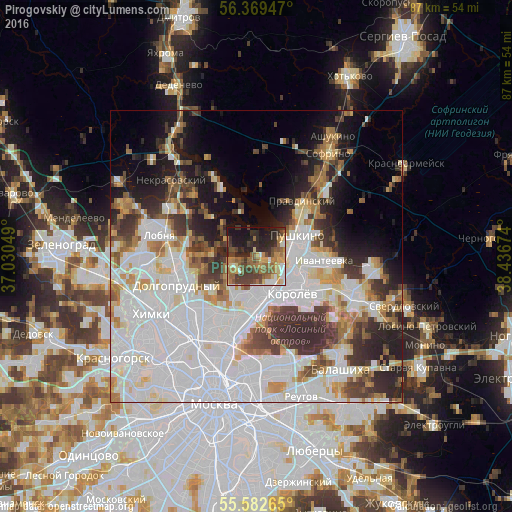
Analysis of Pirogovskiy night lights 2016
Square area 10x10 km:
 2.76%
2.76%90-99
5.01%80-89
6.77%70-79
7.39%60-69
12.78%50-59
10.28%40-49
12.28%30-39
10.28%20-29
16.79%10-19
15.04%0-9
0.63%Square area 50x50 km:
21.85%90-99
10.93%80-89
4.01%70-79
4.05%60-69
4.71%50-59
4.11%40-49
4.3%30-39
6.08%20-29
7.35%10-19
9.41%0-9
23.19%Clear (daylight) street map image can be seen on geolist.org.
Map coordinates:
56° 22' 10.1" North, 37° 1' 49.8" East
55° 58' 41" North, 37° 44' 1" East
55° 34' 57.5" North, 38° 26' 12.3" East
Some cities around Pirogovskiy sort by population:
• Mytishchi
7.4 km =4.6 mi,  181°
181°
• Korolev
9.1 km =5.7 mi,  141°
141°
• Pushkino
9.3 km =5.8 mi,  62°
62°
• Yaroslavskiy
10.6 km =6.6 mi,  185°
185°
• Vatutino
10.8 km =6.7 mi, 194°
• Yubileyny
8 km =5 mi,  128°
128°
• Bolshevo
7.7 km =4.8 mi, 128°
• Mamontovka
5.4 km =3.4 mi,  86°
86°
509392 (p: 6,208)
Sources (retrieved 2019-11-25):
» Earth at Night: Flat Maps 2012, 2016