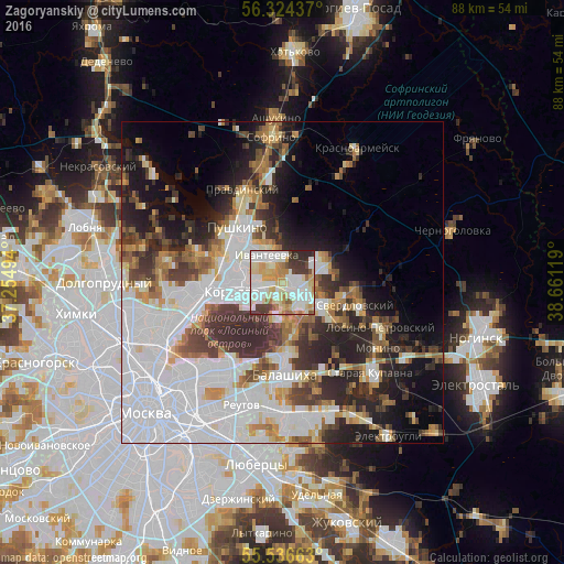
Zagoryanskiy night lights from space
Night Light of Zagoryanskiy (Moscow Oblast) from space (Russia) Src. Average luminocity for 10x10km area is 80.2281% and for 50x50km: 42.9214%.
Analysis of Zagoryanskiy night lights 2016
Square area 10x10 km:
 24.44%
90-99
25.31%80-89
15.16%70-79
9.9%60-69
5.76%50-59
2.88%40-49
4.51%30-39
7.89%20-29
4.14%10-19
0%0-9
0%Square area 50x50 km:
16.91%90-99
8.14%80-89
3.38%70-79
3.76%60-69
4.01%50-59
3.84%40-49
3.86%30-39
5.96%20-29
8.67%10-19
9.2%0-9
32.27%Clear (daylight) street map image can be seen on geolist.org.
Map coordinates:
56° 19' 27.7" North, 37° 15' 17.8" East
55° 55' 57" North, 37° 57' 29" East
55° 32' 11.9" North, 38° 39' 40.3" East
Some cities around Zagoryanskiy sort by population:
• Korolev
8.5 km =5.3 mi,  256°
256°
• Shchelkovo
1.2 km =0.7 mi,  133°
133°
• Pushkino
11 km =6.8 mi,  328°
328°
• Fryazino
6.3 km =3.9 mi,  60°
60°
• Ivanteyevka
4.9 km =3 mi, 331°
• Yubileyny
7.8 km =4.8 mi,  270°
270°
• Bolshevo
8 km =5 mi, 271°
• Mamontovka
10.2 km =6.3 mi,  301°
301°
465632 (p: 7,514)
Sources (retrieved 2019-11-25):
» Earth at Night: Flat Maps 2012, 2016