Yayva night lights from space
Night Light of Yayva (Perm) from space (Russia) Src. Average luminocity for 10x10km area is 3.5455% and for 50x50km: 2.4956%.
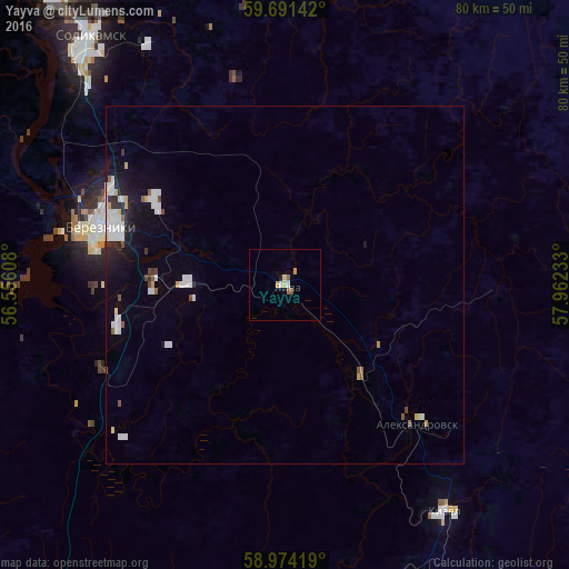
Analysis of Yayva night lights 2016
Square area 10x10 km:
 0.43%
0.43%90-99
0.43%80-89
0.87%70-79
0.76%60-69
0.11%50-59
0.97%40-49
0.32%30-39
0%20-29
0%10-19
0.43%0-9
95.67%Square area 50x50 km:
0.6%90-99
0.61%80-89
0.14%70-79
0.21%60-69
0.05%50-59
0.29%40-49
0.14%30-39
0.14%20-29
0.43%10-19
1.48%0-9
95.9%Clear (daylight) street map image can be seen on geolist.org.
Map coordinates:
59° 41' 29.1" North, 56° 33' 21.9" East
59° 20' 4.9" North, 57° 15' 33.1" East
58° 58' 27.1" North, 57° 57' 44.4" East
Some cities around Yayva sort by population:
• Berezniki
26.2 km =16.3 mi,  288°
288°
• Solikamsk
43.1 km =26.8 mi,  319°
319°
• Gubakha
57.7 km =35.9 mi,  163°
163°
• Kizel
38.9 km =24.2 mi,  145°
145°
• Aleksandrovsk
26.4 km =16.4 mi,  138°
138°
• Gremyachinsk
92.6 km =57.5 mi, 158°
• Ugleural’skiy
47.4 km =29.5 mi, 156°
• Usol’ye
33.9 km =21.1 mi, 286°
468560 (p: 10,615)
Sources (retrieved 2019-11-25):
» Earth at Night: Flat Maps 2012, 2016