Berezniki night lights from space
Night Light of Berezniki (Perm) from space (Russia) Src. Average luminocity for 10x10km area is 47.6093% and for 50x50km: 4.7179%.
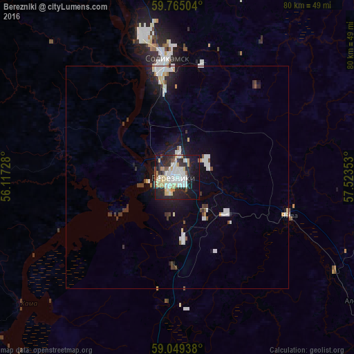
Analysis of Berezniki night lights 2016
Square area 10x10 km:
 13.1%
13.1%90-99
11.26%80-89
7.47%70-79
4.33%60-69
3.14%50-59
1.73%40-49
2.71%30-39
2.6%20-29
20.67%10-19
26.19%0-9
6.82%Square area 50x50 km:
1.03%90-99
1.03%80-89
0.47%70-79
0.36%60-69
0.21%50-59
0.27%40-49
0.35%30-39
0.55%20-29
1.33%10-19
3.51%0-9
90.89%Clear (daylight) street map image can be seen on geolist.org.
Map coordinates:
59° 45' 54.1" North, 56° 7' 2.2" East
59° 24' 32.8" North, 56° 49' 13.4" East
59° 2' 57.8" North, 57° 31' 24.7" East
Some cities around Berezniki sort by population:
• Solikamsk
24.9 km =15.5 mi,  353°
353°
• Dobryanka
107.6 km =66.9 mi,  192°
192°
• Gubakha
76 km =47.2 mi,  146°
146°
• Kizel
61.9 km =38.5 mi,  130°
130°
• Aleksandrovsk
50.9 km =31.6 mi,  123°
123°
• Yayva
26.2 km =16.3 mi,  108°
108°
• Ugleural’skiy
67.9 km =42.2 mi,  139°
139°
• Usol’ye
7.7 km =4.8 mi,  280°
280°
577206 (p: 167,748)
Sources (retrieved 2019-11-25):
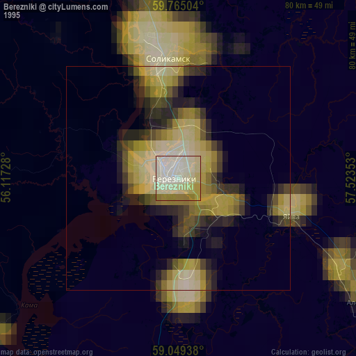
» NASA, Earths city lights 1995
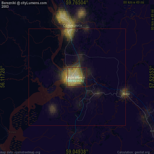
» NASA city lights 2003
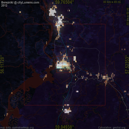
» Earth at Night: Flat Maps 2012, 2016