Yarega night lights from space
Night Light of Yarega (Komi) from space (Russia) Src. Average luminocity for 10x10km area is 10.4206% and for 50x50km: 4.2944%.
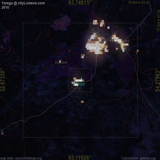
Analysis of Yarega night lights 2016
Square area 10x10 km:
 1.98%
1.98%90-99
2.18%80-89
1.29%70-79
0.2%60-69
1.39%50-59
0.89%40-49
1.19%30-39
0.5%20-29
0.3%10-19
4.46%0-9
85.62%Square area 50x50 km:
0.89%90-99
0.95%80-89
0.36%70-79
0.23%60-69
0.36%50-59
0.37%40-49
0.41%30-39
0.4%20-29
1.2%10-19
4.22%0-9
90.62%Clear (daylight) street map image can be seen on geolist.org.
Map coordinates:
63° 44' 53.3" North, 52° 52' 24.2" East
63° 26' 7.5" North, 53° 34' 35.4" East
63° 7' 9.3" North, 54° 16' 46.7" East
Some cities around Yarega sort by population:
• Ukhta
15.6 km =9.7 mi,  19°
19°
• Sosnogorsk
23.9 km =14.9 mi,  39°
39°
• Yemva
166.2 km =103.3 mi,  235°
235°
• Vuktyl
190.1 km =118.1 mi,  75°
75°
• Nizhniy Odes
67.5 km =41.9 mi,  69°
69°
• Troitsko-Pechorsk
154.7 km =96.1 mi,  121°
121°
• Vodnyy
11.3 km =7 mi,  312°
312°
• Ust’-Kulom
194.6 km =120.9 mi,  178°
178°
468991 (p: 8,092)
Sources (retrieved 2019-11-25):
» Earth at Night: Flat Maps 2012, 2016