Yagunovskiy night lights from space
Night Light of Yagunovskiy (Kemerovo Oblast) from space (Russia) Src. Average luminocity for 10x10km area is 51.6758% and for 50x50km: 19.2715%.
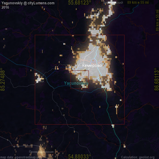
Analysis of Yagunovskiy night lights 2016
Square area 10x10 km:
 12.44%
90-99
15.79%80-89
7.54%70-79
1.32%60-69
5.26%50-59
6.46%40-49
2.39%30-39
5.98%20-29
15.19%10-19
16.03%0-9
11.6%Square area 50x50 km:
6.97%90-99
4.7%80-89
1.64%70-79
1.5%60-69
1.45%50-59
1.49%40-49
1.5%30-39
2.11%20-29
3.12%10-19
5.49%0-9
70.04%Clear (daylight) street map image can be seen on geolist.org.
Map coordinates:
55° 40' 52.4" North, 85° 16' 29.6" East
55° 16' 58.1" North, 85° 58' 40.8" East
54° 52' 49.2" North, 86° 40' 52.1" East
Some cities around Yagunovskiy sort by population:
• Kemerovo
8.7 km =5.4 mi,  49°
49°
• Berëzovskiy
37.9 km =23.5 mi,  21°
21°
• Topki
22.9 km =14.2 mi,  268°
268°
• Kedrovka
27.5 km =17.1 mi, 15°
• Promyshlennaya
46.2 km =28.7 mi,  207°
207°
• Promyshlennovskiy
26.3 km =16.3 mi,  32°
32°
• Pioner
4.1 km =2.5 mi,  335°
335°
• Borovoy
18 km =11.2 mi, 21°
1486525 (p: 8,199)
Sources (retrieved 2019-11-25):
» Earth at Night: Flat Maps 2012, 2016