Vorotynsk night lights from space
Night Light of Vorotynsk (Kaluga) from space (Russia) Src. Average luminocity for 10x10km area is 1.2823% and for 50x50km: 6.0017%.
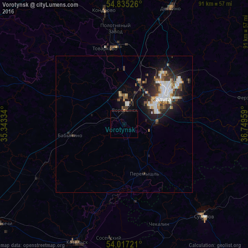
Analysis of Vorotynsk night lights 2016
Square area 10x10 km:
 0%
0%90-99
0%80-89
0%70-79
0.24%60-69
0%50-59
0%40-49
0.24%30-39
0.24%20-29
0.24%10-19
0.48%0-9
98.56%Square area 50x50 km:
1.15%90-99
1.36%80-89
0.4%70-79
0.53%60-69
0.51%50-59
0.64%40-49
0.76%30-39
1.1%20-29
1.69%10-19
3.93%0-9
87.92%Clear (daylight) street map image can be seen on geolist.org.
Map coordinates:
54° 50' 6.9" North, 35° 20' 36" East
54° 25' 41.8" North, 36° 2' 47.3" East
54° 1' 2" North, 36° 44' 58.5" East
Some cities around Vorotynsk sort by population:
• Kaluga
18.6 km =11.6 mi,  52°
52°
• Suvorov
44.8 km =27.8 mi,  139°
139°
• Kozel’sk
47 km =29.2 mi,  202°
202°
• Kondrovo
42.7 km =26.5 mi,  349°
349°
• Tovarkovo
28.4 km =17.6 mi, 345°
• Sosenskiy
41.4 km =25.7 mi,  187°
187°
• Ageyevo
40.6 km =25.2 mi, 137°
• Polotnyanyy Zavod
33 km =20.5 mi, 350°
818487 (p: 10,977)
Sources (retrieved 2019-11-25):
» Earth at Night: Flat Maps 2012, 2016