Polotnyanyy Zavod night lights from space
Night Light of Polotnyanyy Zavod (Kaluga) from space (Russia) Src. Average luminocity for 10x10km area is 3.6078% and for 50x50km: 4.5257%.
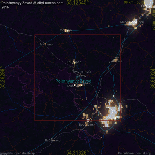
Analysis of Polotnyanyy Zavod night lights 2016
Square area 10x10 km:
 0%
0%90-99
0.63%80-89
0.38%70-79
0.5%60-69
0%50-59
0.5%40-49
1.63%30-39
1.38%20-29
1%10-19
1.13%0-9
92.86%Square area 50x50 km:
0.89%90-99
1.04%80-89
0.35%70-79
0.41%60-69
0.44%50-59
0.55%40-49
0.55%30-39
0.91%20-29
1.32%10-19
2.09%0-9
91.45%Clear (daylight) street map image can be seen on geolist.org.
Map coordinates:
55° 7' 31.6" North, 35° 15' 46.8" East
54° 43' 17" North, 35° 57' 58" East
54° 18' 47.7" North, 36° 40' 9.3" East
Some cities around Polotnyanyy Zavod sort by population:
• Kaluga
29.2 km =18.1 mi,  137°
137°
• Obninsk
58.6 km =36.4 mi,  44°
44°
• Maloyaroslavets
45.9 km =28.5 mi, 44°
• Kondrovo
9.8 km =6.1 mi,  345°
345°
• Tovarkovo
5.3 km =3.3 mi,  199°
199°
• Vorotynsk
33 km =20.5 mi,  170°
170°
• Yukhnov
47.3 km =29.4 mi,  273°
273°
• Medyn’
28.4 km =17.6 mi, 345°
507079 (p: 5,679)
Sources (retrieved 2019-11-25):
» Earth at Night: Flat Maps 2012, 2016