Pechora night lights from space
Night Light of Pechora (Komi) from space (Russia) Src. Average luminocity for 10x10km area is 25.1276% and for 50x50km: 2.2104%.
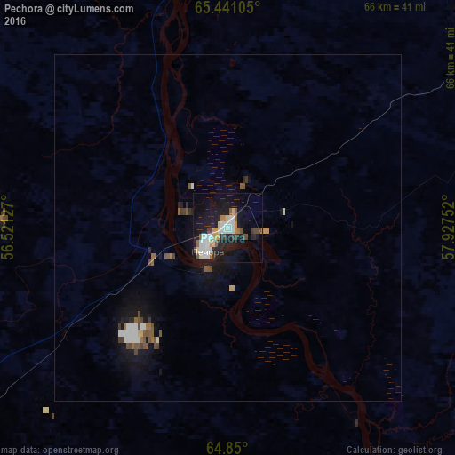
Analysis of Pechora night lights 2016
Square area 10x10 km:
 5.86%
5.86%90-99
4.28%80-89
2.19%70-79
2.45%60-69
1.84%50-59
1.84%40-49
3.23%30-39
2.27%20-29
4.98%10-19
30.24%0-9
40.82%Square area 50x50 km:
0.4%90-99
0.3%80-89
0.14%70-79
0.17%60-69
0.19%50-59
0.37%40-49
0.36%30-39
0.23%20-29
0.32%10-19
2.44%0-9
95.08%Clear (daylight) street map image can be seen on geolist.org.
Map coordinates:
65° 26' 27.8" North, 56° 31' 16.6" East
65° 8' 49.8" North, 57° 13' 27.8" East
64° 51' 0" North, 57° 55' 39.1" East
Some cities around Pechora sort by population:
• Ukhta
244.7 km =152 mi,  224°
224°
• Usinsk
95.2 km =59.2 mi,  8°
8°
• Sosnogorsk
235.2 km =146.1 mi, 223°
• Vuktyl
143.5 km =89.2 mi,  178°
178°
• Nizhniy Odes
202.1 km =125.6 mi,  214°
214°
• Yarega
259.1 km =161 mi, 222°
• Vodnyy
259 km =160.9 mi,  225°
225°
• Ust-Tsilma
238 km =147.9 mi,  277°
277°
511794 (p: 46,113)
Sources (retrieved 2019-11-25):
» Earth at Night: Flat Maps 2012, 2016