Volzhsk night lights from space
Night Light of Volzhsk (Mariy-El Republic) from space (Russia) Src. Average luminocity for 10x10km area is 17.4223% and for 50x50km: 3.1544%.
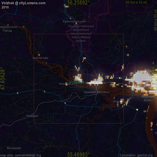
Analysis of Volzhsk night lights 2016
Square area 10x10 km:
 0.5%
0.5%90-99
2.26%80-89
1.88%70-79
4.89%60-69
4.51%50-59
1%40-49
1%30-39
0.5%20-29
0.75%10-19
16.29%0-9
66.42%Square area 50x50 km:
0.38%90-99
0.5%80-89
0.29%70-79
0.38%60-69
0.47%50-59
0.45%40-49
0.25%30-39
0.23%20-29
0.36%10-19
2.74%0-9
93.95%Clear (daylight) street map image can be seen on geolist.org.
Map coordinates:
56° 15' 32.1" North, 47° 39' 22.6" East
55° 51' 59" North, 48° 21' 33.8" East
55° 28' 11.4" North, 49° 3' 45.1" East
Some cities around Volzhsk sort by population:
• Zelenodolsk
10.2 km =6.3 mi,  104°
104°
• Vasil’yevo
22.7 km =14.1 mi, 100°
• Zvenigovo
24.8 km =15.4 mi,  299°
299°
• Kozlovka
7.4 km =4.6 mi,  249°
249°
• Nizhniye Vyazovyye
12.8 km =8 mi,  126°
126°
• Osinovo
32.6 km =20.3 mi,  87°
87°
• Krasnogorskiy
31.9 km =19.8 mi,  356°
356°
• Urmary
33.3 km =20.7 mi,  231°
231°
472234 (p: 58,000)
Sources (retrieved 2019-11-25):
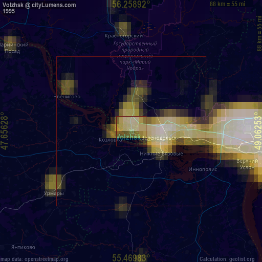
» NASA, Earths city lights 1995
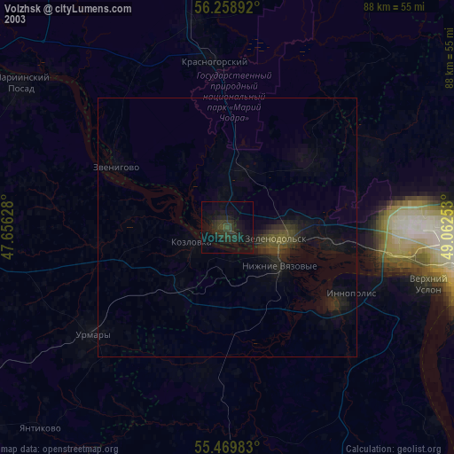
» NASA city lights 2003
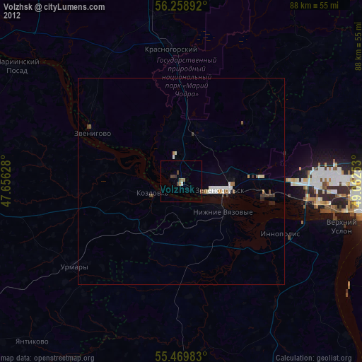
» Earth at Night: Flat Maps 2012, 2016