Zelenodolsk night lights from space
Night Light of Zelenodolsk (Tatarstan Republic) from space (Russia) Src. Average luminocity for 10x10km area is 32.4712% and for 50x50km: 6.2766%.
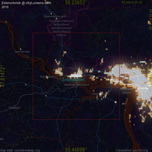
Analysis of Zelenodolsk night lights 2016
Square area 10x10 km:
 8.27%
8.27%90-99
9.15%80-89
3.01%70-79
1.38%60-69
2.38%50-59
1.25%40-49
1.75%30-39
0.38%20-29
5.14%10-19
41.35%0-9
25.94%Square area 50x50 km:
1.1%90-99
1.16%80-89
0.61%70-79
0.75%60-69
0.82%50-59
0.7%40-49
0.4%30-39
0.54%20-29
1.32%10-19
4.54%0-9
88.06%Clear (daylight) street map image can be seen on geolist.org.
Map coordinates:
56° 14' 11.5" North, 47° 48' 53" East
55° 50' 37.5" North, 48° 31' 4.2" East
55° 26' 49.1" North, 49° 13' 15.5" East
Some cities around Zelenodolsk sort by population:
• Volzhsk
10.2 km =6.3 mi,  284°
284°
• Vasil’yevo
12.5 km =7.8 mi,  96°
96°
• Zvenigovo
34.7 km =21.6 mi,  294°
294°
• Kozlovka
16.8 km =10.4 mi,  269°
269°
• Nizhniye Vyazovyye
5 km =3.1 mi,  175°
175°
• Osinovo
23 km =14.3 mi,  79°
79°
• Krasnogorskiy
36.3 km =22.6 mi,  340°
340°
• Staroye Arakchino
28.6 km =17.8 mi, 98°
463835 (p: 99,600)
Sources (retrieved 2019-11-25):
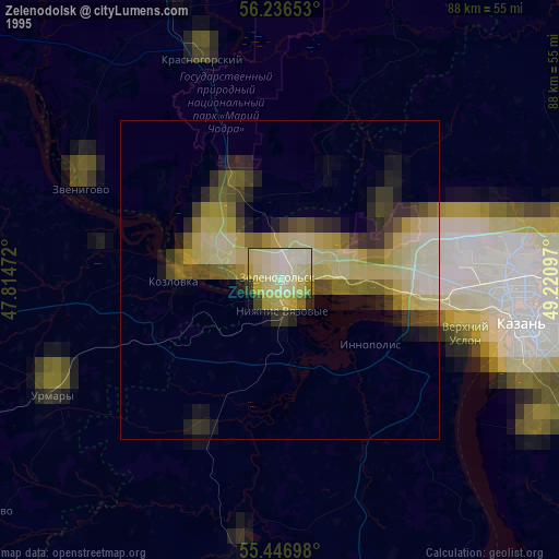
» NASA, Earths city lights 1995
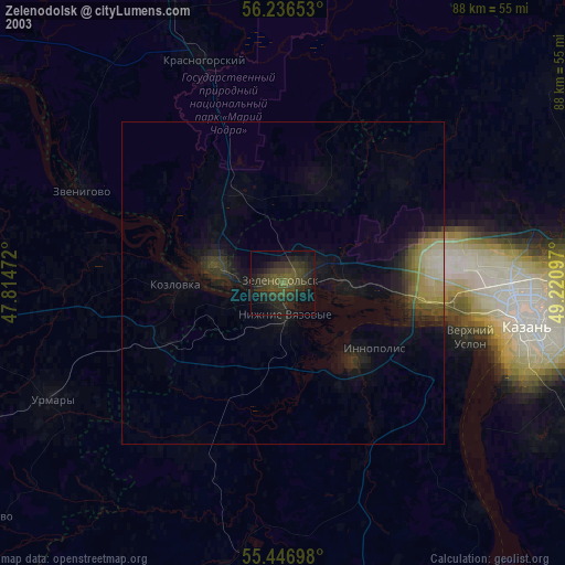
» NASA city lights 2003
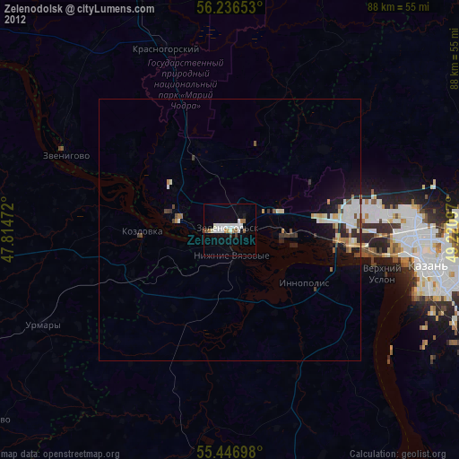
» Earth at Night: Flat Maps 2012, 2016