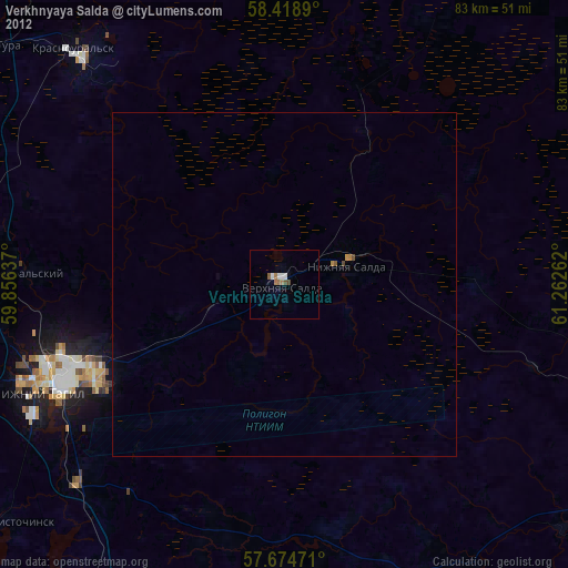
Verkhnyaya Salda night lights from space
Night Light of Verkhnyaya Salda (Sverdlovsk) from space (Russia) Src. Average luminocity for 10x10km area is 7.6845% and for 50x50km: 0.711%.
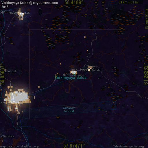
Analysis of Verkhnyaya Salda night lights 2016
Square area 10x10 km:
 0.95%
0.95%90-99
1.9%80-89
0%70-79
1.43%60-69
0.83%50-59
1.07%40-49
0%30-39
1.79%20-29
1.79%10-19
0.24%0-9
90%Square area 50x50 km:
0.04%90-99
0.1%80-89
0.02%70-79
0.11%60-69
0.13%50-59
0.19%40-49
0.07%30-39
0.09%20-29
0.1%10-19
0.32%0-9
98.83%Clear (daylight) street map image can be seen on geolist.org.
Map coordinates:
58° 25' 8" North, 59° 51' 22.9" East
58° 2' 55.5" North, 60° 33' 34.2" East
57° 40' 29" North, 61° 15' 45.4" East
Some cities around Verkhnyaya Salda sort by population:
• Nizhny Tagil
37.9 km =23.5 mi,  247°
247°
• Kushva
54.1 km =33.6 mi,  299°
299°
• Krasnoural’sk
46.4 km =28.8 mi,  319°
319°
• Nev’yansk
64.9 km =40.3 mi,  198°
198°
• Nizhnyaya Salda
10 km =6.2 mi,  71°
71°
• Baranchinskiy
52.1 km =32.4 mi,  283°
283°
• Svobodnyy
9.7 km =6 mi,  264°
264°
• Tsementnyy
68.8 km =42.8 mi, 200°
1487277 (p: 48,992)
Sources (retrieved 2019-11-25):
» Earth at Night: Flat Maps 2012, 2016