Kushva night lights from space
Night Light of Kushva (Sverdlovsk) from space (Russia) Src. Average luminocity for 10x10km area is 7.1723% and for 50x50km: 0.9119%.
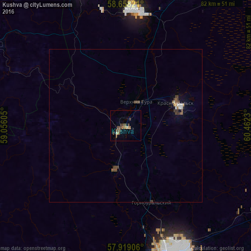
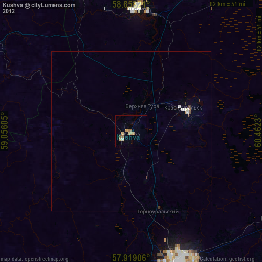
Analysis of Kushva night lights 2016
Square area 10x10 km:
 0%
0%90-99
0.45%80-89
0.91%70-79
0.91%60-69
0.57%50-59
2.15%40-49
3.51%30-39
1.93%20-29
0.45%10-19
0.11%0-9
89%Square area 50x50 km:
0.08%90-99
0.09%80-89
0.05%70-79
0.09%60-69
0.08%50-59
0.19%40-49
0.33%30-39
0.32%20-29
0.05%10-19
0.16%0-9
98.57%Clear (daylight) street map image can be seen on geolist.org.
Map coordinates:
58° 39' 29.6" North, 59° 3' 21.8" East
58° 17' 26" North, 59° 45' 33" East
57° 55' 8.6" North, 60° 27' 44.3" East
Some cities around Kushva sort by population:
• Nizhny Tagil
43 km =26.7 mi,  163°
163°
• Kachkanar
48.3 km =30 mi,  340°
340°
• Krasnoural’sk
18.3 km =11.4 mi,  63°
63°
• Lesnoy
38.6 km =24 mi,  3°
3°
• Nizhnyaya Tura
37.8 km =23.5 mi, 4°
• Baranchinskiy
14.8 km =9.2 mi,  193°
193°
• Verkhnyaya Tura
8.3 km =5.2 mi,  19°
19°
• Svobodnyy
46.6 km =29 mi,  126°
126°
538340 (p: 34,058)
Sources (retrieved 2019-11-25):
» Earth at Night: Flat Maps 2012, 2016