Nizhny Tagil night lights from space
Night Light of Nizhny Tagil (Sverdlovsk) from space (Russia) Src. Average luminocity for 10x10km area is 61.6917% and for 50x50km: 4.8638%.
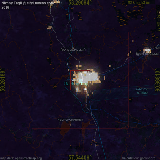

Analysis of Nizhny Tagil night lights 2016
Square area 10x10 km:
 13.1%
13.1%90-99
20%80-89
10.48%70-79
4.17%60-69
7.38%50-59
5.95%40-49
3.57%30-39
10.24%20-29
9.4%10-19
11.19%0-9
4.52%Square area 50x50 km:
0.84%90-99
1.2%80-89
0.53%70-79
0.45%60-69
0.63%50-59
0.46%40-49
0.35%30-39
0.71%20-29
1.58%10-19
2.69%0-9
90.56%Clear (daylight) street map image can be seen on geolist.org.
Map coordinates:
58° 17' 27.4" North, 59° 15' 42.8" East
57° 55' 10" North, 59° 57' 54" East
57° 32' 38.6" North, 60° 40' 5.3" East
Some cities around Nizhny Tagil sort by population:
• Verkhnyaya Salda
37.9 km =23.5 mi,  67°
67°
• Kushva
43 km =26.7 mi,  343°
343°
• Krasnoural’sk
49.6 km =30.8 mi,  5°
5°
• Nev’yansk
49.4 km =30.7 mi,  162°
162°
• Baranchinskiy
31.2 km =19.4 mi,  329°
329°
• Verkhnyaya Tura
49.9 km =31 mi,  349°
349°
• Svobodnyy
28.7 km =17.8 mi,  62°
62°
• Tsementnyy
51.3 km =31.9 mi,  167°
167°
520494 (p: 381,116)
Sources (retrieved 2019-11-25):
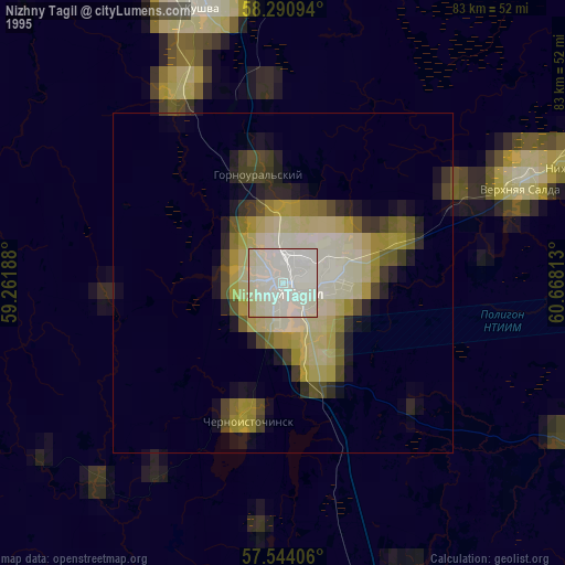
» NASA, Earths city lights 1995
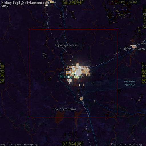
» NASA city lights 2003
» Earth at Night: Flat Maps 2012, 2016