Velikiy Novgorod night lights from space
Night Light of Velikiy Novgorod (Novgorod Oblast) from space (Russia) Src. Average luminocity for 10x10km area is 53.6775% and for 50x50km: 3.657%.
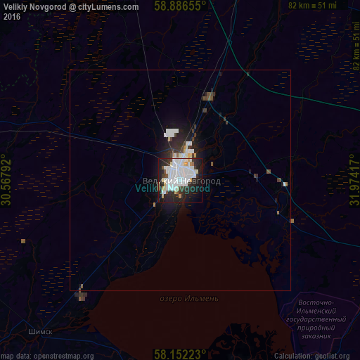
Analysis of Velikiy Novgorod night lights 2016
Square area 10x10 km:
 21.75%
90-99
15.37%80-89
4%70-79
2.16%60-69
0.76%50-59
1.08%40-49
2.27%30-39
4.87%20-29
18.83%10-19
22.4%0-9
6.49%Square area 50x50 km:
1.13%90-99
0.84%80-89
0.25%70-79
0.11%60-69
0.09%50-59
0.18%40-49
0.35%30-39
0.55%20-29
1.36%10-19
2.46%0-9
92.68%Clear (daylight) street map image can be seen on geolist.org.
Map coordinates:
58° 53' 11.6" North, 30° 34' 4.5" East
58° 31' 16.7" North, 31° 16' 15.7" East
58° 9' 8" North, 31° 58' 27" East
Some cities around Velikiy Novgorod sort by population:
• Staraya Russa
58.8 km =36.5 mi,  174°
174°
• Chudovo
70.3 km =43.7 mi,  19°
19°
• Malaya Vishera
65.7 km =40.8 mi,  56°
56°
• Sol’tsy
70.8 km =44 mi,  231°
231°
• Pankovka
4.8 km =3 mi,  240°
240°
• Kresttsy
78.8 km =49 mi,  112°
112°
• Parfino
64.8 km =40.3 mi,  160°
160°
• Proletariy
27 km =16.8 mi, 111°
519336 (p: 215,062)
Sources (retrieved 2019-11-25):
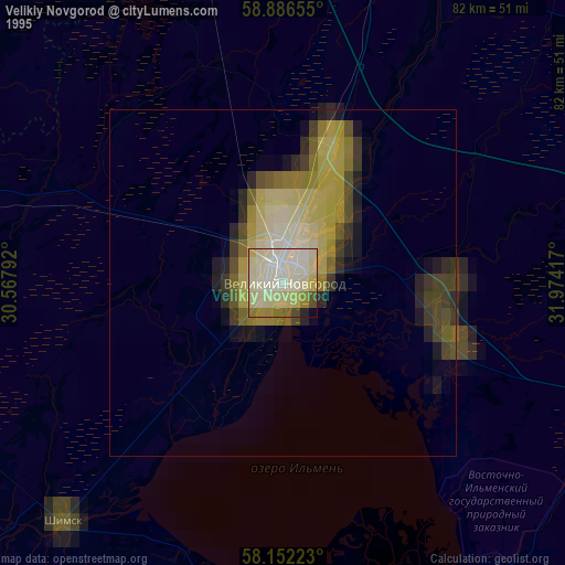
» NASA, Earths city lights 1995
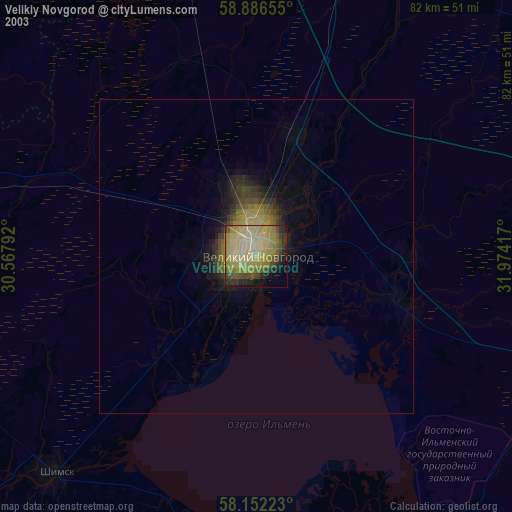
» NASA city lights 2003
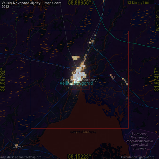
» Earth at Night: Flat Maps 2012, 2016