Vakhrushi night lights from space
Night Light of Vakhrushi (Kirov) from space (Russia) Src. Average luminocity for 10x10km area is 0% and for 50x50km: 6.7328%.
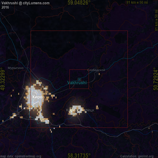
Analysis of Vakhrushi night lights 2016
Square area 10x10 km:
 0%
0%90-99
0%80-89
0%70-79
0%60-69
0%50-59
0%40-49
0%30-39
0%20-29
0%10-19
0%0-9
100%Square area 50x50 km:
1.86%90-99
1.63%80-89
0.8%70-79
0.46%60-69
0.63%50-59
0.28%40-49
0.35%30-39
0.72%20-29
1.6%10-19
4.14%0-9
87.54%Clear (daylight) street map image can be seen on geolist.org.
Map coordinates:
59° 2' 53.7" North, 49° 19' 22.8" East
58° 41' 5" North, 50° 1' 34" East
58° 19' 2.5" North, 50° 43' 45.3" East
Some cities around Vakhrushi sort by population:
• Kirov
23.3 km =14.5 mi,  245°
245°
• Kirovo-Chepetsk
14.6 km =9.1 mi,  176°
176°
• Slobodskoy
10.2 km =6.3 mi,  58°
58°
• Lyangasovo
38.3 km =23.8 mi,  241°
241°
• Belaya Kholunitsa
50.7 km =31.5 mi,  70°
70°
• Raduzhnyy
30.3 km =18.8 mi,  227°
227°
• Murygino
33.3 km =20.7 mi,  280°
280°
• Kumëny
64.3 km =40 mi,  185°
185°
477340 (p: 10,330)
Sources (retrieved 2019-11-25):
» Earth at Night: Flat Maps 2012, 2016