Kirovo-Chepetsk night lights from space
Night Light of Kirovo-Chepetsk (Kirov) from space (Russia) Src. Average luminocity for 10x10km area is 27.8333% and for 50x50km: 6.3694%.
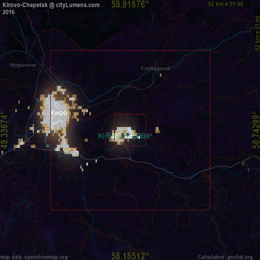
Analysis of Kirovo-Chepetsk night lights 2016
Square area 10x10 km:
 4.44%
4.44%90-99
9.52%80-89
4.44%70-79
1.84%60-69
2.06%50-59
1.41%40-49
0.97%30-39
0%20-29
5.63%10-19
27.06%0-9
42.64%Square area 50x50 km:
1.62%90-99
1.54%80-89
0.75%70-79
0.46%60-69
0.65%50-59
0.28%40-49
0.35%30-39
0.67%20-29
1.48%10-19
4.04%0-9
88.15%Clear (daylight) street map image can be seen on geolist.org.
Map coordinates:
58° 55' 7.5" North, 49° 20' 12.3" East
58° 33' 13.9" North, 50° 2' 23.5" East
58° 11' 6.4" North, 50° 44' 34.8" East
Some cities around Kirovo-Chepetsk sort by population:
• Slobodskoy
21.4 km =13.3 mi,  21°
21°
• Lyangasovo
34.6 km =21.5 mi,  263°
263°
• Belaya Kholunitsa
56.7 km =35.2 mi,  55°
55°
• Raduzhnyy
23.8 km =14.8 mi, 255°
• Vakhrushi
14.6 km =9.1 mi,  356°
356°
• Murygino
39.4 km =24.5 mi,  301°
301°
• Orichi
59.5 km =37 mi,  253°
253°
• Kumëny
50 km =31.1 mi,  188°
188°
548395 (p: 90,252)
Sources (retrieved 2019-11-25):
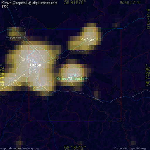
» NASA, Earths city lights 1995
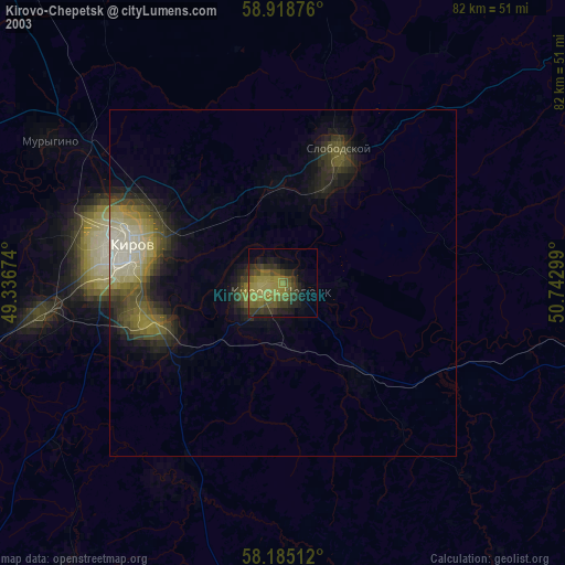
» NASA city lights 2003
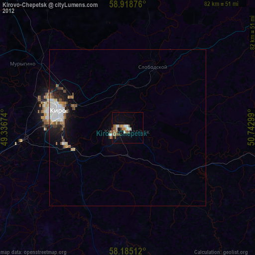
» Earth at Night: Flat Maps 2012, 2016