Tuymazy night lights from space
Night Light of Tuymazy (Bashkortostan Republic) from space (Russia) Src. Average luminocity for 10x10km area is 33.7168% and for 50x50km: 3.4491%.
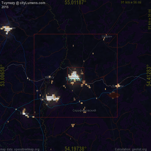
Analysis of Tuymazy night lights 2016
Square area 10x10 km:
 9.27%
9.27%90-99
6.64%80-89
2.88%70-79
2.63%60-69
3.51%50-59
3.13%40-49
2.51%30-39
0.5%20-29
6.39%10-19
38.85%0-9
23.68%Square area 50x50 km:
0.66%90-99
0.56%80-89
0.2%70-79
0.32%60-69
0.34%50-59
0.38%40-49
0.58%30-39
0.29%20-29
0.37%10-19
3.64%0-9
92.66%Clear (daylight) street map image can be seen on geolist.org.
Map coordinates:
55° 0' 42.7" North, 53° 0' 23.7" East
54° 36' 24" North, 53° 42' 34.9" East
54° 11' 50.6" North, 54° 24' 46.2" East
Some cities around Tuymazy sort by population:
• Oktyabr’skiy
20.8 km =12.9 mi,  227°
227°
• Bavly
37.5 km =23.3 mi, 230°
• Kandry
26.6 km =16.5 mi,  99°
99°
• Urussu
15.9 km =9.9 mi,  266°
266°
• Serafimovskiy
21.1 km =13.1 mi,  164°
164°
• Buzdyak
54.2 km =33.7 mi,  92°
92°
• Subkhankulovo
8.5 km =5.3 mi,  129°
129°
• Sharan
29.9 km =18.6 mi,  38°
38°
480089 (p: 68,829)
Sources (retrieved 2019-11-25):
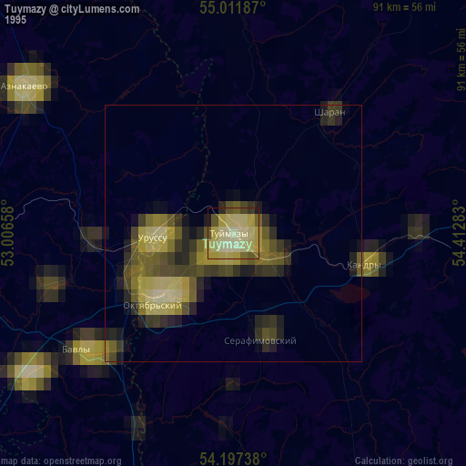
» NASA, Earths city lights 1995
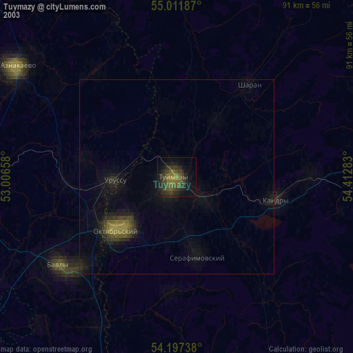
» NASA city lights 2003
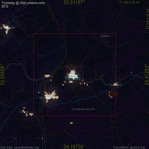
» Earth at Night: Flat Maps 2012, 2016