Troitskiy night lights from space
Night Light of Troitskiy (Belgorod Oblast) from space (Russia) Src. Average luminocity for 10x10km area is 3.2941% and for 50x50km: 5.0892%.
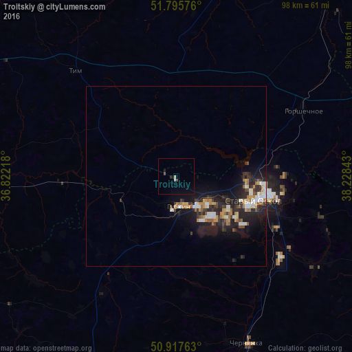
Analysis of Troitskiy night lights 2016
Square area 10x10 km:
 0.28%
0.28%90-99
0.28%80-89
0.56%70-79
0%60-69
0%50-59
0.56%40-49
0.56%30-39
0%20-29
0.56%10-19
1.26%0-9
95.94%Square area 50x50 km:
0.67%90-99
0.84%80-89
0.41%70-79
0.55%60-69
0.8%50-59
0.51%40-49
0.48%30-39
0.92%20-29
2.07%10-19
4.59%0-9
88.16%Clear (daylight) street map image can be seen on geolist.org.
Map coordinates:
51° 47' 44.7" North, 36° 49' 19.8" East
51° 21' 31.7" North, 37° 31' 31.1" East
50° 55' 3.5" North, 38° 13' 42.3" East
Some cities around Troitskiy sort by population:
• Staryy Oskol
23 km =14.3 mi,  107°
107°
• Gubkin
8.7 km =5.4 mi,  170°
170°
• Chernyanka
50.4 km =31.3 mi,  157°
157°
• Gorshechnoye
39.9 km =24.8 mi,  62°
62°
• Kshenskiy
55.2 km =34.3 mi,  13°
13°
• Nizhnedevitsk
61.7 km =38.3 mi,  70°
70°
• Korocha
65.1 km =40.5 mi,  201°
201°
• Pristen’
59.3 km =36.8 mi,  256°
256°
481580 (p: 6,236)
Sources (retrieved 2019-11-25):
» Earth at Night: Flat Maps 2012, 2016