Nizhnedevitsk night lights from space
Night Light of Nizhnedevitsk (Voronezj) from space (Russia) Src. Average luminocity for 10x10km area is 0% and for 50x50km: 0.0162%.
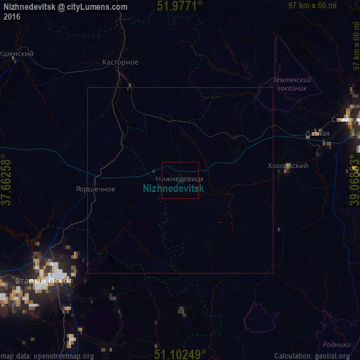
Analysis of Nizhnedevitsk night lights 2016
Square area 10x10 km:
 0%
0%90-99
0%80-89
0%70-79
0%60-69
0%50-59
0%40-49
0%30-39
0%20-29
0%10-19
0%0-9
100%Square area 50x50 km:
0%90-99
0%80-89
0%70-79
0%60-69
0%50-59
0%40-49
0%30-39
0%20-29
0.04%10-19
0.02%0-9
99.94%Clear (daylight) street map image can be seen on geolist.org.
Map coordinates:
51° 58' 37.6" North, 37° 39' 45.3" East
51° 32' 30.8" North, 38° 21' 56.5" East
51° 6' 9" North, 39° 4' 7.8" East
Some cities around Nizhnedevitsk sort by population:
• Staryy Oskol
45.4 km =28.2 mi,  233°
233°
• Rossosh’
47.9 km =29.8 mi,  167°
167°
• Semiluki
48.4 km =30.1 mi,  70°
70°
• Pridonskoy
51.3 km =31.9 mi, 72°
• Latnaya
39.2 km =24.4 mi, 70°
• Gorshechnoye
22.9 km =14.2 mi,  265°
265°
• Shilovo
50 km =31.1 mi,  89°
89°
• Kshenskiy
55.9 km =34.7 mi,  306°
306°
521148 (p: 6,320)
Sources (retrieved 2019-11-25):
» Earth at Night: Flat Maps 2012, 2016