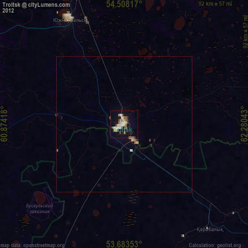
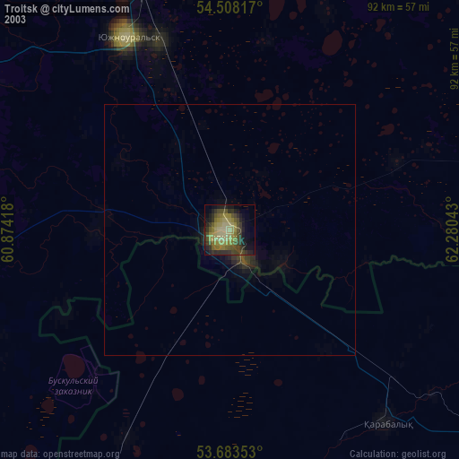
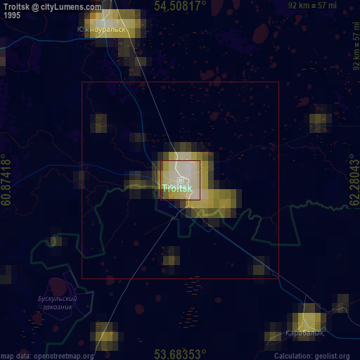
Troitsk night lights from space
Night Light of Troitsk (Chelyabinsk) from space (Russia) Src. Average luminocity for 10x10km area is 24.7967% and for 50x50km: 1.4503%.

Analysis of Troitsk night lights 2016
Square area 10x10 km:
 3.03%
3.03%90-99
4.29%80-89
4.8%70-79
3.54%60-69
2.78%50-59
3.54%40-49
0.25%30-39
2.15%20-29
0.51%10-19
33.96%0-9
41.16%Square area 50x50 km:
0.14%90-99
0.2%80-89
0.25%70-79
0.22%60-69
0.14%50-59
0.26%40-49
0.11%30-39
0.15%20-29
0.04%10-19
1.4%0-9
97.1%Clear (daylight) street map image can be seen on geolist.org.
Map coordinates:
54° 30' 29.4" North, 60° 52' 27" East
54° 5' 52.4" North, 61° 34' 38.3" East
53° 41' 0.7" North, 62° 16' 49.5" East
Some cities around Troitsk sort by population:
• Yuzhnoural’sk
43.6 km =27.1 mi,  331°
331°
• Yemanzhelinsk
74.9 km =46.5 mi,  347°
347°
• Plast
58.1 km =36.1 mi,  301°
301°
• Krasnogorskiy
60.4 km =37.5 mi,  338°
338°
• Uvel’skiy
41.1 km =25.5 mi, 339°
• Komsomolets, KZ
49.9 km =31 mi,  140°
140°
• Yetkul’
80.5 km =50 mi,  0°
0°
• Chesma
68.3 km =42.4 mi,  242°
242°
1489246 (p: 82,338)
Sources (retrieved 2019-11-25):
» NASA, Earths city lights 1995
» NASA city lights 2003
» Earth at Night: Flat Maps 2012, 2016