Smolensk night lights from space
Night Light of Smolensk from space (Russia) Src. Average luminocity for 10x10km area is 72.1223% and for 50x50km: 4.7642%.
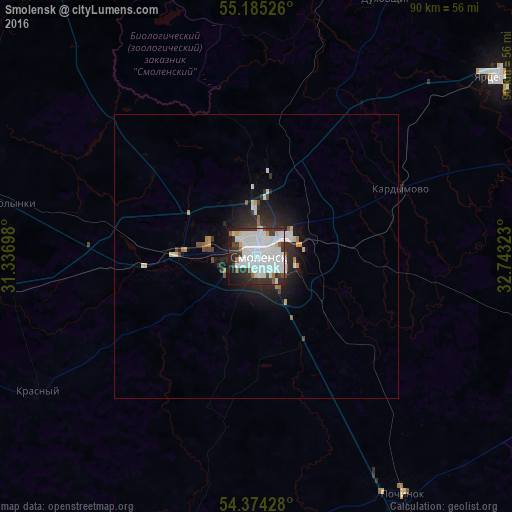
Analysis of Smolensk night lights 2016
Square area 10x10 km:
 37.84%
90-99
19.56%80-89
3.35%70-79
1.03%60-69
1.16%50-59
3.6%40-49
2.83%30-39
10.17%20-29
11.07%10-19
8.62%0-9
0.77%Square area 50x50 km:
1.6%90-99
0.96%80-89
0.3%70-79
0.22%60-69
0.23%50-59
0.28%40-49
0.34%30-39
0.69%20-29
1.7%10-19
2.88%0-9
90.79%Clear (daylight) street map image can be seen on geolist.org.
Map coordinates:
55° 11' 6.9" North, 31° 20' 13.1" East
54° 46' 54.5" North, 32° 2' 24.4" East
54° 22' 27.4" North, 32° 44' 35.6" East
Some cities around Smolensk sort by population:
• Yartsevo
52.6 km =32.7 mi,  52°
52°
• Safonovo
84.5 km =52.5 mi,  64°
64°
• Dorogobuzh
81.8 km =50.8 mi,  79°
79°
• Yel’nya
76.9 km =47.8 mi,  107°
107°
• Rudnya
63.3 km =39.3 mi,  286°
286°
• Pochinok
49 km =30.4 mi,  148°
148°
• Demidov
63.8 km =39.6 mi,  328°
328°
• Lyozna, BY
83.9 km =52.1 mi, 288°
491687 (p: 320,991)
Sources (retrieved 2019-11-25):
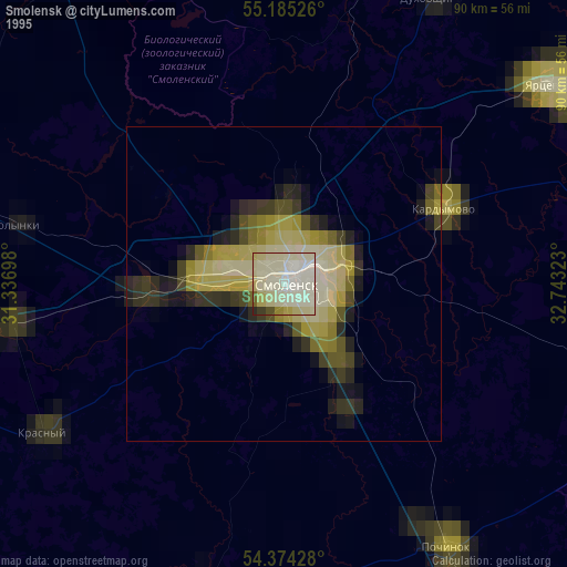
» NASA, Earths city lights 1995
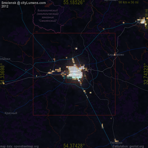
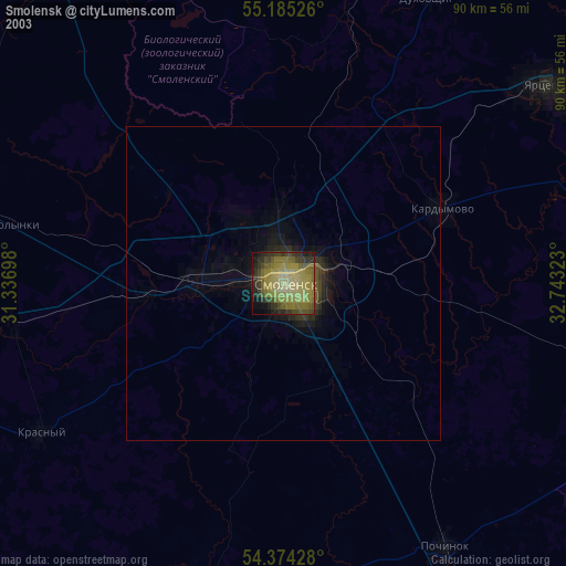
» NASA city lights 2003
» Earth at Night: Flat Maps 2012, 2016