Shakhty night lights from space
Night Light of Shakhty (Rostov) from space (Russia) Src. Average luminocity for 10x10km area is 57.4911% and for 50x50km: 6.7895%.
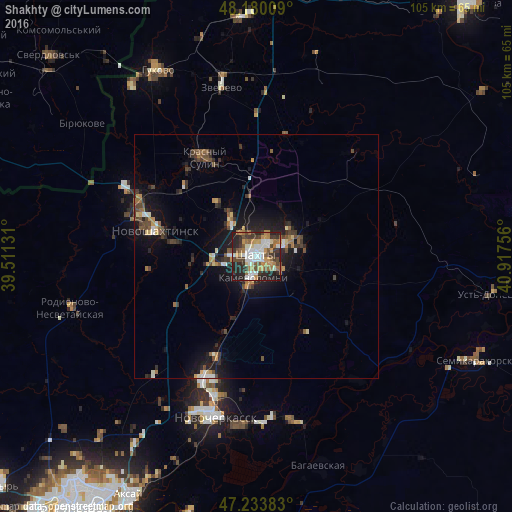
Analysis of Shakhty night lights 2016
Square area 10x10 km:
 11.16%
90-99
12.8%80-89
3.87%70-79
11.31%60-69
9.52%50-59
5.95%40-49
7.74%30-39
10.86%20-29
19.94%10-19
6.85%0-9
0%Square area 50x50 km:
0.65%90-99
0.89%80-89
0.5%70-79
1%60-69
0.83%50-59
0.94%40-49
1.27%30-39
1.4%20-29
2.28%10-19
5.19%0-9
85.05%Clear (daylight) street map image can be seen on geolist.org.
Map coordinates:
48° 10' 48.3" North, 39° 30' 40.7" East
47° 42' 32.8" North, 40° 12' 51.9" East
47° 14' 1.8" North, 40° 55' 3.2" East
Some cities around Shakhty sort by population:
• Novoshakhtinsk
21.8 km =13.5 mi,  285°
285°
• Krasnyy Sulin
23 km =14.3 mi,  332°
332°
• Kamenolomni
4.6 km =2.9 mi,  188°
188°
• Mayskiy
8.5 km =5.3 mi,  260°
260°
• Ayutinskiy
9.5 km =5.9 mi, 328°
• Sokolovo-Kundryuchenskiy
24.4 km =15.2 mi,  305°
305°
• Talovyy
13.5 km =8.4 mi,  324°
324°
• Sambek
28.9 km =18 mi,  277°
277°
496015 (p: 221,312)
Sources (retrieved 2019-11-25):
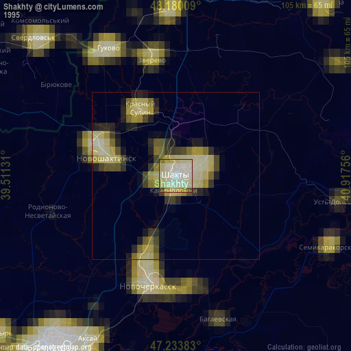
» NASA, Earths city lights 1995
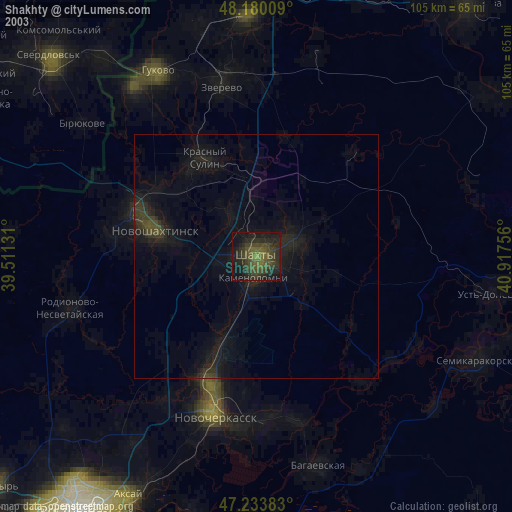
» NASA city lights 2003
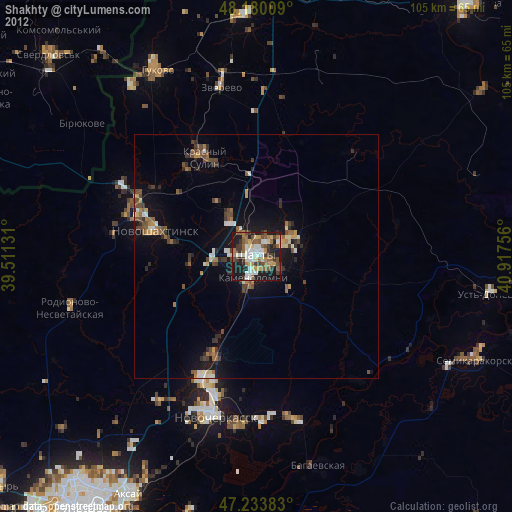
» Earth at Night: Flat Maps 2012, 2016