Ayutinskiy night lights from space
Night Light of Ayutinskiy (Rostov) from space (Russia) Src. Average luminocity for 10x10km area is 16.5536% and for 50x50km: 6.6606%.
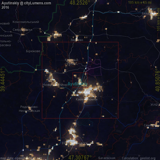
Analysis of Ayutinskiy night lights 2016
Square area 10x10 km:
 0.45%
0.45%90-99
0.89%80-89
1.49%70-79
2.53%60-69
2.98%50-59
1.19%40-49
3.27%30-39
5.36%20-29
5.95%10-19
18.75%0-9
57.14%Square area 50x50 km:
0.67%90-99
0.81%80-89
0.46%70-79
1%60-69
0.81%50-59
0.99%40-49
1.23%30-39
1.43%20-29
2.26%10-19
4.67%0-9
85.67%Clear (daylight) street map image can be seen on geolist.org.
Map coordinates:
48° 15' 9.4" North, 39° 26' 40.2" East
47° 46' 56.2" North, 40° 8' 51.5" East
47° 18' 27.6" North, 40° 51' 2.7" East
Some cities around Ayutinskiy sort by population:
• Shakhty
9.5 km =5.9 mi,  148°
148°
• Novoshakhtinsk
16.2 km =10.1 mi,  261°
261°
• Krasnyy Sulin
13.5 km =8.4 mi,  334°
334°
• Kamenolomni
13.4 km =8.3 mi,  161°
161°
• Mayskiy
10.2 km =6.3 mi,  199°
199°
• Sokolovo-Kundryuchenskiy
16.1 km =10 mi,  291°
291°
• Talovyy
4 km =2.5 mi,  314°
314°
• Sambek
24.1 km =15 mi, 259°
580139 (p: 10,623)
Sources (retrieved 2019-11-25):
» Earth at Night: Flat Maps 2012, 2016