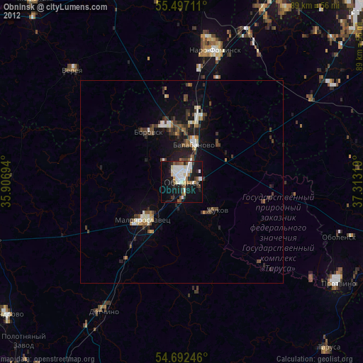
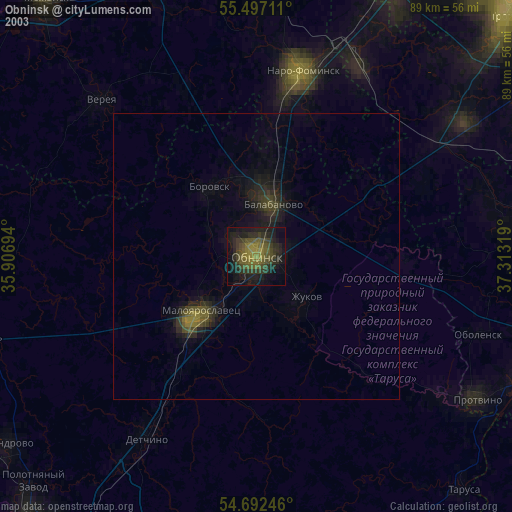
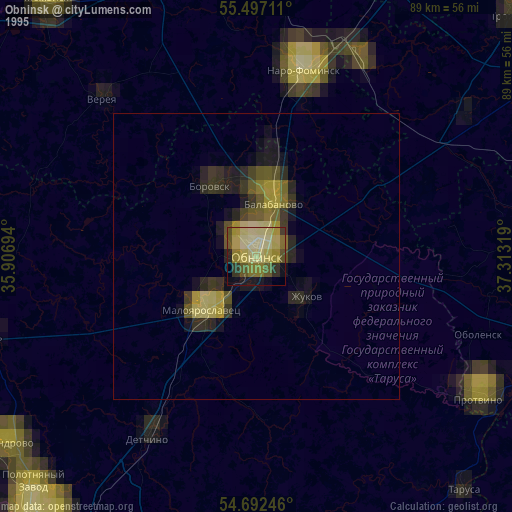
Obninsk night lights from space
Night Light of Obninsk (Kaluga) from space (Russia) Src. Average luminocity for 10x10km area is 48.3421% and for 50x50km: 7.0027%.
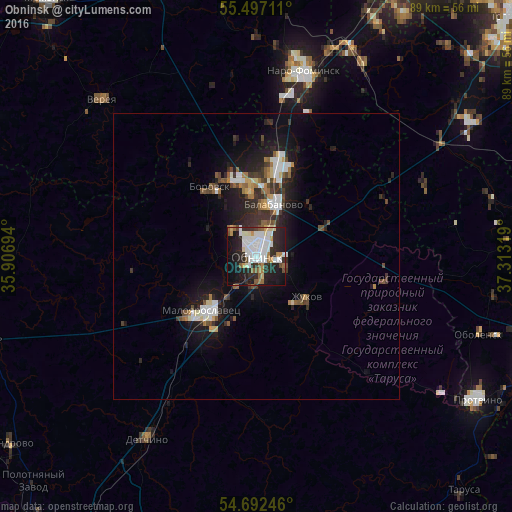
Analysis of Obninsk night lights 2016
Square area 10x10 km:
 14.54%
90-99
12.78%80-89
3.01%70-79
3.01%60-69
5.01%50-59
4.01%40-49
2.01%30-39
4.01%20-29
21.05%10-19
22.81%0-9
7.77%Square area 50x50 km:
1.21%90-99
1.27%80-89
0.54%70-79
0.42%60-69
0.8%50-59
0.84%40-49
0.85%30-39
1.29%20-29
2.54%10-19
5.87%0-9
84.39%Clear (daylight) street map image can be seen on geolist.org.
Map coordinates:
55° 29' 49.6" North, 35° 54' 25" East
55° 5' 48.5" North, 36° 36' 36.2" East
54° 41' 32.9" North, 37° 18' 47.5" East
Some cities around Obninsk sort by population:
• Naro-Fominsk
33.3 km =20.7 mi,  13°
13°
• Maloyaroslavets
12.7 km =7.9 mi,  223°
223°
• Balabanovo
10 km =6.2 mi,  18°
18°
• Zhukovo
11.2 km =7 mi,  130°
130°
• Kremenki
40.1 km =24.9 mi, 125°
• Borovsk
14.5 km =9 mi,  327°
327°
• Yermolino
10.9 km =6.8 mi,  355°
355°
• Belousovo
4 km =2.5 mi,  92°
92°
516436 (p: 107,392)
Sources (retrieved 2019-11-25):
» NASA, Earths city lights 1995
» NASA city lights 2003
» Earth at Night: Flat Maps 2012, 2016