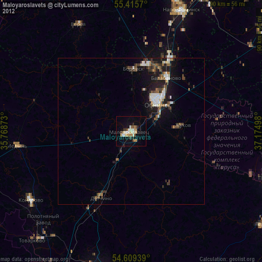
Maloyaroslavets night lights from space
Night Light of Maloyaroslavets (Kaluga) from space (Russia) Src. Average luminocity for 10x10km area is 26.1998% and for 50x50km: 6.2662%.
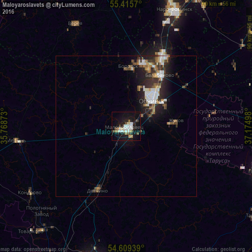
Analysis of Maloyaroslavets night lights 2016
Square area 10x10 km:
 5.14%
5.14%90-99
5.5%80-89
3.59%70-79
0.84%60-69
2.15%50-59
1.67%40-49
3.11%30-39
2.63%20-29
3.47%10-19
31.58%0-9
40.31%Square area 50x50 km:
1.14%90-99
1.14%80-89
0.51%70-79
0.41%60-69
0.75%50-59
0.82%40-49
0.73%30-39
1.24%20-29
2.28%10-19
4.51%0-9
86.48%Clear (daylight) street map image can be seen on geolist.org.
Map coordinates:
55° 24' 56.5" North, 35° 46' 7.4" East
55° 0' 52.5" North, 36° 28' 18.7" East
54° 36' 33.8" North, 37° 10' 29.9" East
Some cities around Maloyaroslavets sort by population:
• Obninsk
12.7 km =7.9 mi,  43°
43°
• Balabanovo
22.1 km =13.7 mi,  32°
32°
• Kondrovo
41.8 km =26 mi,  236°
236°
• Zhukovo
17.5 km =10.9 mi,  83°
83°
• Borovsk
21.3 km =13.2 mi,  2°
2°
• Yermolino
21.5 km =13.4 mi,  21°
21°
• Belousovo
15.6 km =9.7 mi,  55°
55°
• Medyn’
39.4 km =24.5 mi,  262°
262°
530849 (p: 32,669)
Sources (retrieved 2019-11-25):
» Earth at Night: Flat Maps 2012, 2016