Orlov night lights from space
Night Light of Orlov (Kirov) from space (Russia) Src. Average luminocity for 10x10km area is 0.2706% and for 50x50km: 0.0881%.
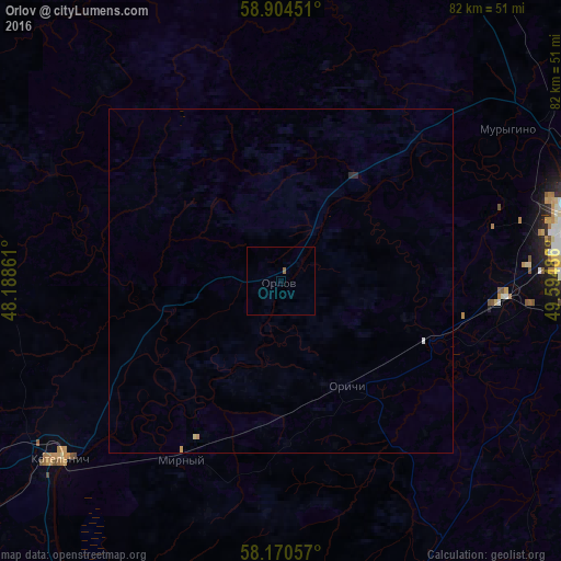
Analysis of Orlov night lights 2016
Square area 10x10 km:
 0%
0%90-99
0%80-89
0%70-79
0%60-69
0%50-59
0.43%40-49
0%30-39
0%20-29
0%10-19
0%0-9
99.57%Square area 50x50 km:
0.02%90-99
0%80-89
0.02%70-79
0.04%60-69
0%50-59
0.02%40-49
0%30-39
0%20-29
0.05%10-19
0%0-9
99.86%Clear (daylight) street map image can be seen on geolist.org.
Map coordinates:
58° 54' 16.2" North, 48° 11' 19" East
58° 32' 22.1" North, 48° 53' 30.2" East
58° 10' 14.1" North, 49° 35' 41.5" East
Some cities around Orlov sort by population:
• Kirov
45 km =28 mi,  81°
81°
• Kirovo-Chepetsk
66.6 km =41.4 mi,  88°
88°
• Kotel’nich
40.7 km =25.3 mi,  230°
230°
• Lyangasovo
32.3 km =20.1 mi, 94°
• Raduzhnyy
43.9 km =27.3 mi,  95°
95°
• Murygino
39.5 km =24.5 mi,  56°
56°
• Orichi
17.9 km =11.1 mi,  147°
147°
• Darovskoy
59.9 km =37.2 mi,  295°
295°
550785 (p: 8,400)
Sources (retrieved 2019-11-25):
» Earth at Night: Flat Maps 2012, 2016