Nizhneye Kazanishche night lights from space
Night Light of Nizhneye Kazanishche (Dagestan) from space (Russia) Src. Average luminocity for 10x10km area is 24.1318% and for 50x50km: 6.672%.
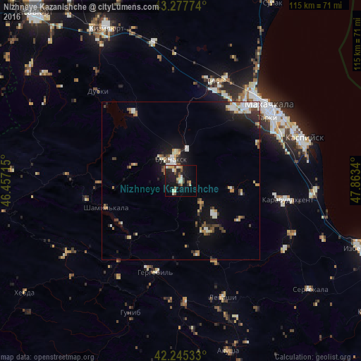
Analysis of Nizhneye Kazanishche night lights 2016
Square area 10x10 km:
 1.21%
1.21%90-99
5.76%80-89
4.09%70-79
2.42%60-69
1.97%50-59
3.33%40-49
2.88%30-39
1.36%20-29
7.42%10-19
25%0-9
44.55%Square area 50x50 km:
0.67%90-99
1.62%80-89
0.63%70-79
0.74%60-69
0.59%50-59
0.71%40-49
0.71%30-39
0.96%20-29
1.66%10-19
4.74%0-9
86.98%Clear (daylight) street map image can be seen on geolist.org.
Map coordinates:
43° 16' 39.9" North, 46° 27' 25.7" East
42° 45' 49.3" North, 47° 9' 37" East
42° 14' 43.2" North, 47° 51' 48.2" East
Some cities around Nizhneye Kazanishche sort by population:
• Buynaksk
7 km =4.3 mi,  331°
331°
• Leninkent
27.7 km =17.2 mi,  34°
34°
• Chirkey
26.5 km =16.5 mi, 326°
• Shamil’kala
25.7 km =16 mi,  250°
250°
• Verkhneye Kazanishche
3.6 km =2.2 mi,  210°
210°
• Korkmaskala
30.9 km =19.2 mi,  20°
20°
• Dorgeli
15.3 km =9.5 mi,  134°
134°
• Gergebil’
29.8 km =18.5 mi,  194°
194°
520955 (p: 11,765)
Sources (retrieved 2019-11-25):
» Earth at Night: Flat Maps 2012, 2016