Myskhako night lights from space
Night Light of Myskhako (Krasnodarskiy) from space (Russia) Src. Average luminocity for 10x10km area is 27.2939% and for 50x50km: 9.5063%.
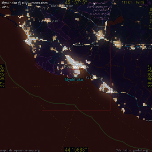
Analysis of Myskhako night lights 2016
Square area 10x10 km:
 5.91%
5.91%90-99
6.67%80-89
0.76%70-79
1.52%60-69
3.33%50-59
1.52%40-49
0.91%30-39
5.15%20-29
13.18%10-19
23.03%0-9
38.03%Square area 50x50 km:
1.88%90-99
2.14%80-89
0.72%70-79
0.74%60-69
0.69%50-59
0.75%40-49
0.68%30-39
1.24%20-29
3.18%10-19
7.49%0-9
80.49%Clear (daylight) street map image can be seen on geolist.org.
Map coordinates:
45° 9' 25.7" North, 37° 3' 46.8" East
44° 39' 33" North, 37° 45' 58" East
44° 9' 24.8" North, 38° 28' 9.3" East
Some cities around Myskhako sort by population:
• Novorossiysk
7.3 km =4.5 mi,  0°
0°
• Krymsk
34.9 km =21.7 mi,  30°
30°
• Gelendzhik
27.4 km =17 mi,  113°
113°
• Rayevskaya
25.7 km =16 mi,  319°
319°
• Kabardinka
14 km =8.7 mi,  93°
93°
• Gayduk
14.9 km =9.3 mi,  339°
339°
• Verkhnebakanskiy
22.8 km =14.2 mi, 337°
• Divnomorskoye
34 km =21.1 mi,  120°
120°
523842 (p: 7,954)
Sources (retrieved 2019-11-25):
» Earth at Night: Flat Maps 2012, 2016