Luza night lights from space
Night Light of Luza (Kirov) from space (Russia) Src. Average luminocity for 10x10km area is 0.2273% and for 50x50km: 0.0093%.
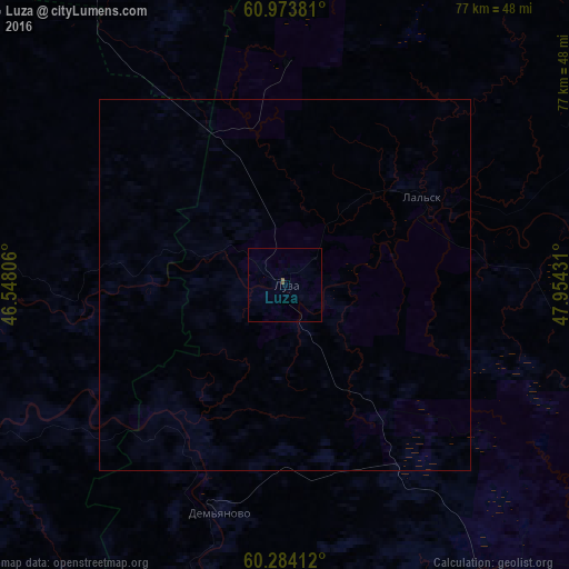
Analysis of Luza night lights 2016
Square area 10x10 km:
 0%
0%90-99
0%80-89
0%70-79
0%60-69
0%50-59
0.41%40-49
0%30-39
0%20-29
0%10-19
0%0-9
99.59%Square area 50x50 km:
0%90-99
0%80-89
0%70-79
0%60-69
0%50-59
0.02%40-49
0%30-39
0%20-29
0%10-19
0%0-9
99.98%Clear (daylight) street map image can be seen on geolist.org.
Map coordinates:
60° 58' 25.7" North, 46° 32' 53" East
60° 37' 50.9" North, 47° 15' 4.2" East
60° 17' 2.8" North, 47° 57' 15.5" East
Some cities around Luza sort by population:
• Kotlas
76.9 km =47.8 mi,  335°
335°
• Koryazhma
76.1 km =47.3 mi,  356°
356°
• Velikiy Ustyug
53.1 km =33 mi,  285°
285°
• Vychegodskiy
71.1 km =44.2 mi, 344°
• Nikol’sk
157.3 km =97.7 mi,  219°
219°
• Krasavino
55.6 km =34.5 mi,  311°
311°
• Kichmengskiy Gorodok
108.3 km =67.3 mi,  228°
228°
• Dem’yanovo
32.4 km =20.1 mi,  196°
196°
533143 (p: 11,935)
Sources (retrieved 2019-11-25):
» Earth at Night: Flat Maps 2012, 2016