Krasnokamensk night lights from space
Night Light of Krasnokamensk (Transbaikal Territory) from space (Russia) Src. Average luminocity for 10x10km area is 17.242% and for 50x50km: 1.2521%.
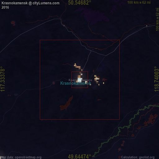
Analysis of Krasnokamensk night lights 2016
Square area 10x10 km:
 3.34%
3.34%90-99
4.14%80-89
1.07%70-79
0.94%60-69
0.67%50-59
2.81%40-49
0.53%30-39
2.27%20-29
0.53%10-19
17.25%0-9
66.44%Square area 50x50 km:
0.15%90-99
0.2%80-89
0.08%70-79
0.13%60-69
0.21%50-59
0.19%40-49
0.1%30-39
0.19%20-29
0.08%10-19
0.79%0-9
97.85%Clear (daylight) street map image can be seen on geolist.org.
Map coordinates:
50° 32' 48.6" North, 117° 20' 1.6" East
50° 5' 52.4" North, 118° 2' 12.8" East
49° 38' 41.1" North, 118° 44' 24.1" East
Some cities around Krasnokamensk sort by population:
• Hailar, CN
155.9 km =96.9 mi,  129°
129°
• Jalai Nur, CN
76 km =47.2 mi,  198°
198°
• Manzhouli, CN
70.3 km =43.7 mi,  218°
218°
• Borzya
112.7 km =70 mi,  286°
286°
• Baley
192.1 km =119.4 mi,  329°
329°
• Zabaykal’sk
71.2 km =44.2 mi,  225°
225°
• Olovyannaya
198.7 km =123.5 mi,  298°
298°
• Priargunsk
81.5 km =50.6 mi,  68°
68°
2021618 (p: 54,316)
Sources (retrieved 2019-11-25):
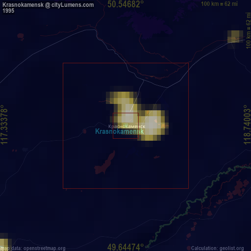
» NASA, Earths city lights 1995
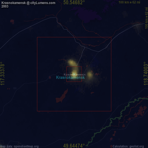
» NASA city lights 2003
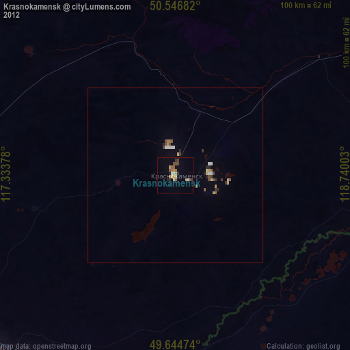
» Earth at Night: Flat Maps 2012, 2016