Manzhouli night lights from space
Night Light of Manzhouli (Inner Mongolia) from space (China) Src. Average luminocity for 10x10km area is 28.1064% and for 50x50km: 2.3941%.
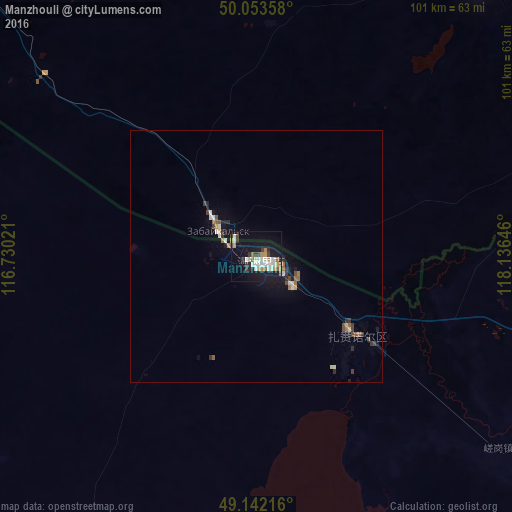
Analysis of Manzhouli night lights 2016
Square area 10x10 km:
 4.62%
4.62%90-99
6.58%80-89
1.12%70-79
4.76%60-69
2.52%50-59
3.22%40-49
1.96%30-39
3.36%20-29
2.1%10-19
34.03%0-9
35.71%Square area 50x50 km:
0.28%90-99
0.43%80-89
0.13%70-79
0.24%60-69
0.25%50-59
0.38%40-49
0.27%30-39
0.39%20-29
0.39%10-19
2.23%0-9
95.02%Clear (daylight) street map image can be seen on geolist.org.
Map coordinates:
50° 3' 12.9" North, 116° 43' 48.8" East
49° 36' 0" North, 117° 25' 60" East
49° 8' 31.8" North, 118° 8' 11.3" East
Some cities around Manzhouli sort by population:
• Hailar
169.9 km =105.6 mi,  105°
105°
• Jalai Nur
25.5 km =15.8 mi,  130°
130°
• Krasnokamensk, RU
70.3 km =43.7 mi,  38°
38°
• Borzya, RU
109 km =67.7 mi,  323°
323°
• Baley, RU
227.4 km =141.3 mi,  345°
345°
• Zabaykal’sk, RU
9.6 km =6 mi,  306°
306°
• Olovyannaya, RU
200.3 km =124.5 mi, 318°
• Priargunsk, RU
146.7 km =91.2 mi,  54°
54°
2035836 (p: 54,808)
Sources (retrieved 2019-11-25):
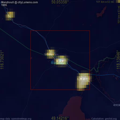
» NASA, Earths city lights 1995
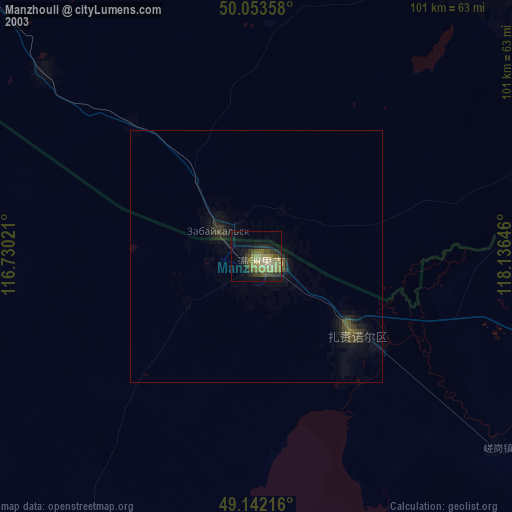
» NASA city lights 2003
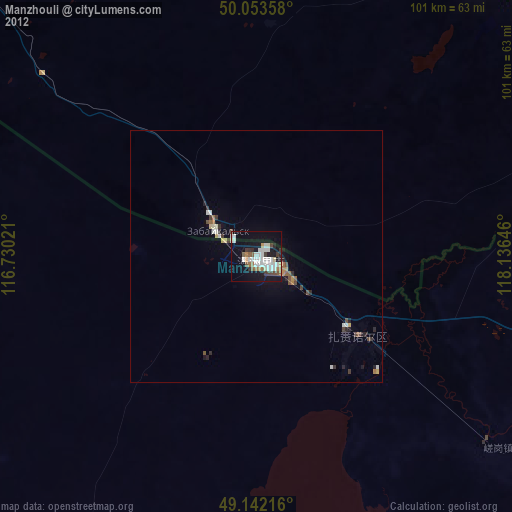
» Earth at Night: Flat Maps 2012, 2016