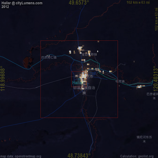
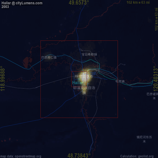
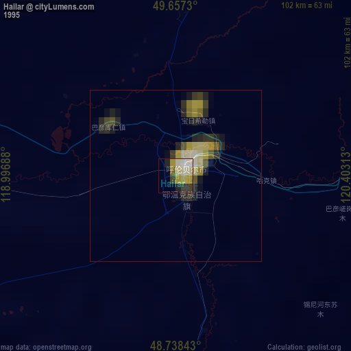
Hailar night lights from space
Night Light of Hailar (Inner Mongolia) from space (China) Src. Average luminocity for 10x10km area is 22.6597% and for 50x50km: 1.9149%.

Analysis of Hailar night lights 2016
Square area 10x10 km:
 3.08%
3.08%90-99
3.08%80-89
1.68%70-79
4.76%60-69
4.76%50-59
3.36%40-49
2.24%30-39
2.94%20-29
5.46%10-19
15.83%0-9
52.8%Square area 50x50 km:
0.21%90-99
0.24%80-89
0.08%70-79
0.28%60-69
0.24%50-59
0.32%40-49
0.28%30-39
0.39%20-29
0.51%10-19
1.4%0-9
96.05%Clear (daylight) street map image can be seen on geolist.org.
Map coordinates:
49° 39' 26.3" North, 118° 59' 48.8" East
49° 12' 0" North, 119° 42' 0" East
48° 44' 18.3" North, 120° 24' 11.3" East
Some cities around Hailar sort by population:
• Zhalantun
259.5 km =161.2 mi,  120°
120°
• Yakeshi
75.6 km =47 mi,  82°
82°
• Jalai Nur
147.6 km =91.7 mi,  280°
280°
• Genhe
218.7 km =135.9 mi,  36°
36°
• Manzhouli
169.9 km =105.6 mi,  285°
285°
• Krasnokamensk, RU
155.9 km =96.9 mi,  309°
309°
• Zabaykal’sk, RU
178.9 km =111.2 mi, 286°
• Priargunsk, RU
136.9 km =85.1 mi,  341°
341°
2037078 (p: 211,066)
Sources (retrieved 2019-11-25):
» NASA, Earths city lights 1995
» NASA city lights 2003
» Earth at Night: Flat Maps 2012, 2016