Kosterevo night lights from space
Night Light of Kosterevo (Vladimir) from space (Russia) Src. Average luminocity for 10x10km area is 0.8571% and for 50x50km: 1.1136%.
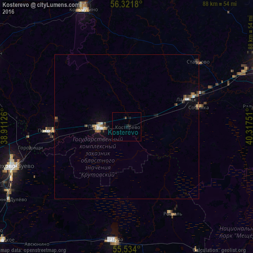
Analysis of Kosterevo night lights 2016
Square area 10x10 km:
 0%
0%90-99
0%80-89
0%70-79
0%60-69
0%50-59
0.5%40-49
0%30-39
0%20-29
0.75%10-19
1.75%0-9
96.99%Square area 50x50 km:
0.09%90-99
0.15%80-89
0.1%70-79
0.05%60-69
0.18%50-59
0.26%40-49
0.15%30-39
0.13%20-29
0.24%10-19
0.38%0-9
98.26%Clear (daylight) street map image can be seen on geolist.org.
Map coordinates:
56° 19' 18.5" North, 38° 54' 40.5" East
55° 55' 47.6" North, 39° 36' 51.8" East
55° 32' 2.4" North, 40° 19' 3" East
Some cities around Kosterevo sort by population:
• Orekhovo-Zuyevo
43 km =26.7 mi,  251°
251°
• Shatura
40 km =24.9 mi,  186°
186°
• Roshal’
33.3 km =20.7 mi,  150°
150°
• Sobinka
25.5 km =15.8 mi,  75°
75°
• Lakinsk
23 km =14.3 mi,  64°
64°
• Pokrov
27.6 km =17.1 mi,  267°
267°
• Petushki
9.6 km =6 mi, 267°
• Stavrovo
33.5 km =20.8 mi,  47°
47°
461720 (p: 9,349)
Sources (retrieved 2019-11-25):
» Earth at Night: Flat Maps 2012, 2016