Petushki night lights from space
Night Light of Petushki (Vladimir) from space (Russia) Src. Average luminocity for 10x10km area is 14.3233% and for 50x50km: 1.0116%.
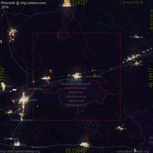
Analysis of Petushki night lights 2016
Square area 10x10 km:
 1.38%
1.38%90-99
2.63%80-89
2.01%70-79
0.75%60-69
2.26%50-59
3.76%40-49
1.25%30-39
0.5%20-29
1%10-19
6.14%0-9
78.32%Square area 50x50 km:
0.07%90-99
0.17%80-89
0.12%70-79
0.08%60-69
0.15%50-59
0.21%40-49
0.11%30-39
0.08%20-29
0.21%10-19
0.39%0-9
98.41%Clear (daylight) street map image can be seen on geolist.org.
Map coordinates:
56° 19' 6" North, 38° 45' 28.5" East
55° 55' 35" North, 39° 27' 39.7" East
55° 31' 49.6" North, 40° 9' 51" East
Some cities around Petushki sort by population:
• Orekhovo-Zuyevo
33.9 km =21.1 mi,  246°
246°
• Kabanovo
38.4 km =23.9 mi,  238°
238°
• Roshal’
38.6 km =24 mi,  137°
137°
• Sobinka
34.9 km =21.7 mi,  79°
79°
• Lakinsk
32 km =19.9 mi,  71°
71°
• Pokrov
18 km =11.2 mi,  267°
267°
• Kosterevo
9.6 km =6 mi,  87°
87°
• Demikhovo
38.8 km =24.1 mi, 248°
509697 (p: 15,866)
Sources (retrieved 2019-11-25):
» Earth at Night: Flat Maps 2012, 2016